Didn’t we determine on another thread that this was a turntable for reversing the direction of engines and cars?
1 Like
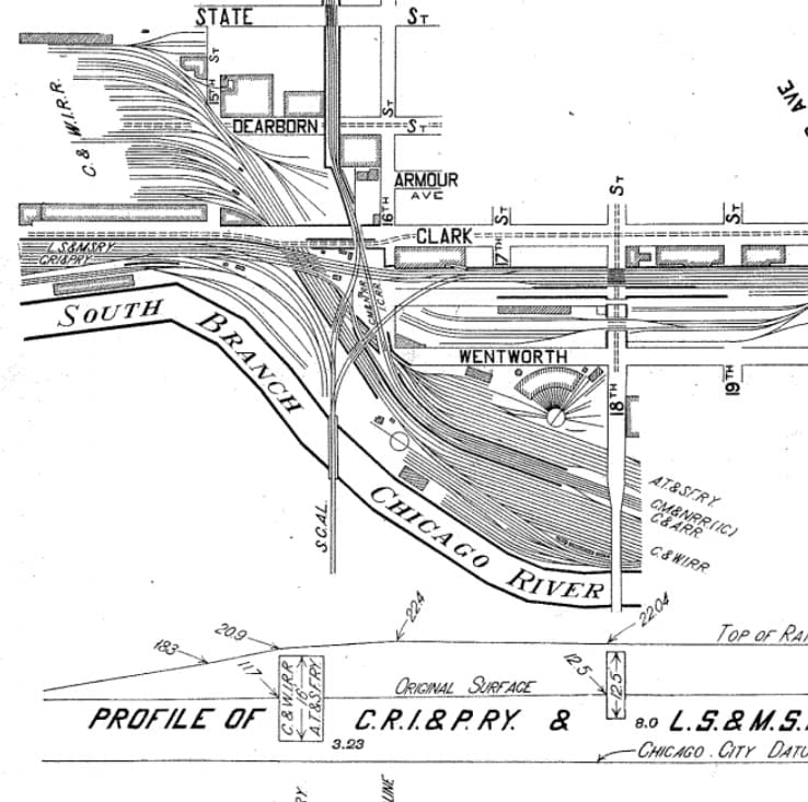
I saw this map here: Industrial History: C&WI "Trench" and links to the 15th and 16th Street Towers
see the note at the bottom of the picture:
and below that:

Simon
2 Likes
Here is another map:

From : Industrial History: St. Charles Air Line Bridge Before Elevation
We can spot two large turntables, and one tiny one, right side of the number 21 on the map.
Simon
2 Likes
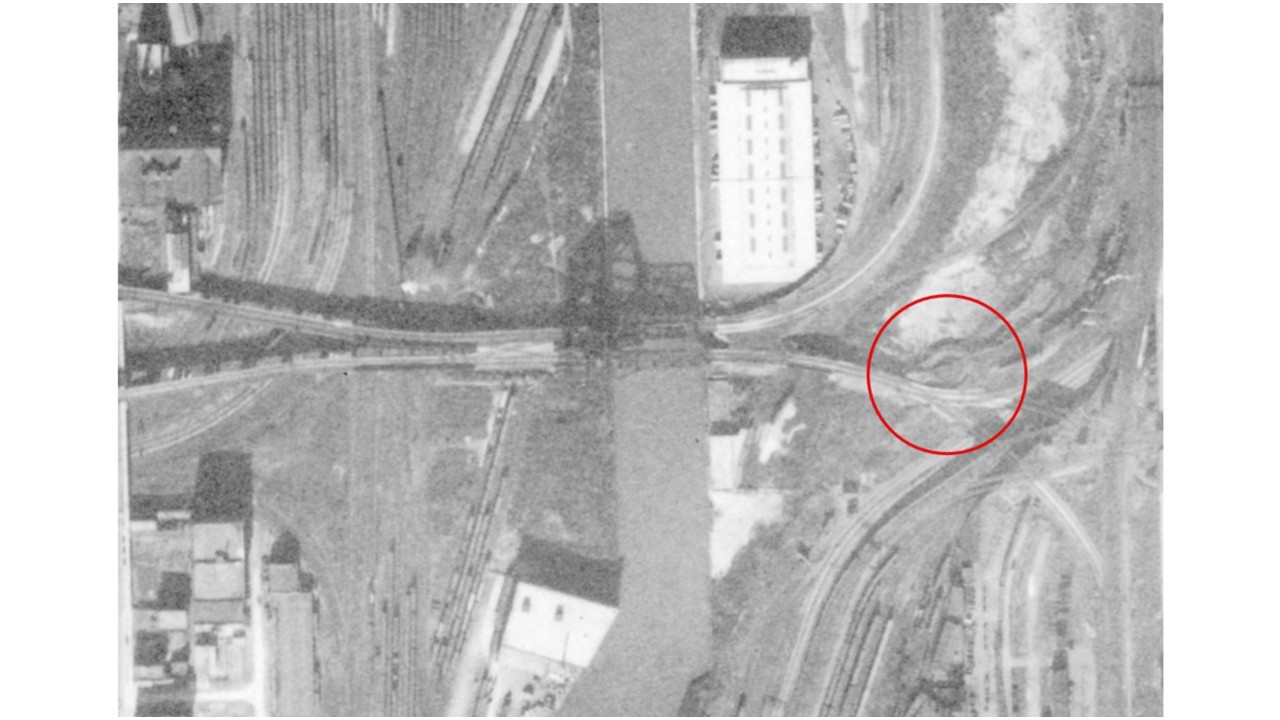
As the originator of this thread, I started it because for years I have been puzzled by a feature on a map, a large circle with no explanation of what it represents. I have placed a red arrow pointing to that circle on the map that follows.
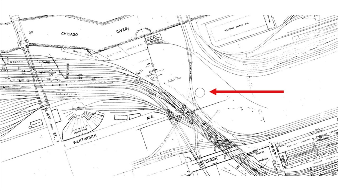
I am now convinced that the circle represents an abandoned turntable. If you look to the left of that circle on the map, you will see a turntable which is an AT&SF turntable with a bridge track on it, a 100’ turntable. That December 1953 map is drawn to scale which would indicate that the abandoned turntable, absent its bridge track, was a 90’ turntable.
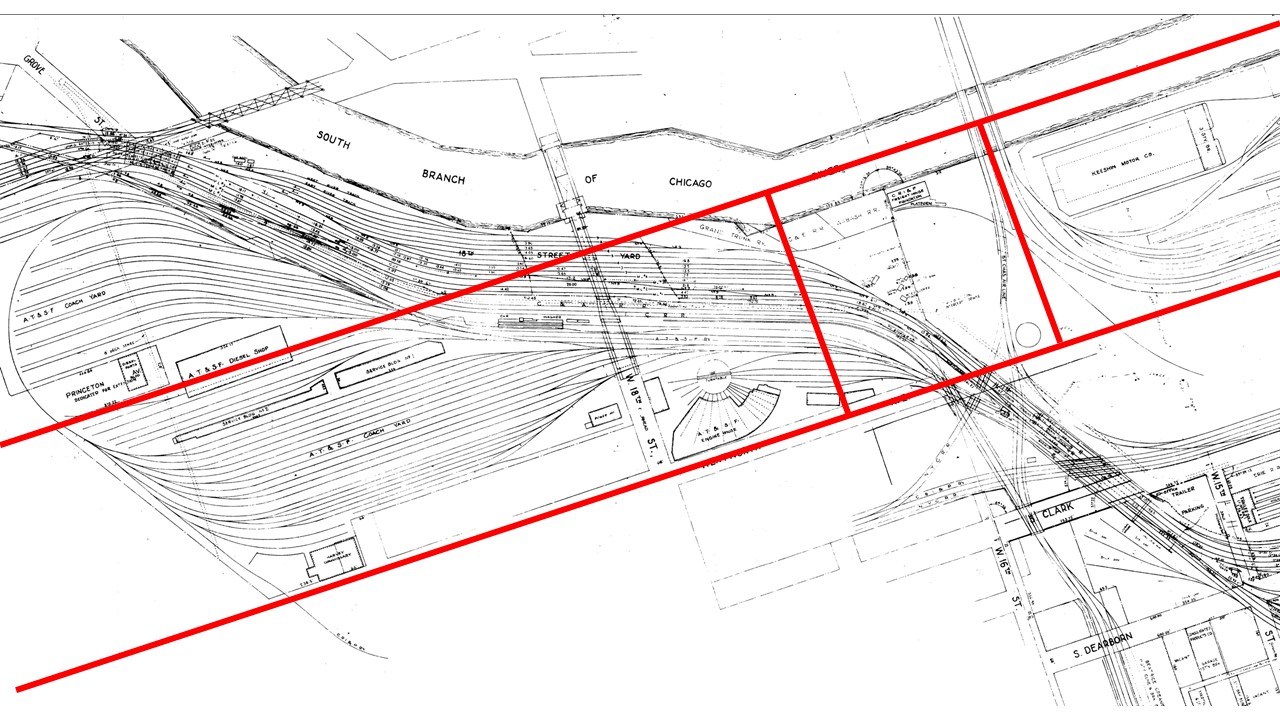
That map represents about one square mile of track for a host of different railroads, nearly a dozen in total. So, the question then becomes, whose turntable was it? The answer requires a bit of sleuthing by going back in time to learn more about the origins of the turntable.
My first step in solving this mystery was to pinpoint the exact location of the turntable as closely as possible. I drew some lines on the map that follows to assist me in locating the turntable in old photos and drawings. In the map that follows, the abandoned turntable sits on the west side of Wentworth Street (200 West) between 15th and 16th Streets. Following the straightening of the South Branch of the Chicago River in 1929, the center of the straightened river ran north and south along what was originally Princeton Avenue (300 West). You can see a reference to Princeton Avenue on the far left side of the map. So, the abandoned turntable is in the lower right-hand corner of the red bordered box. In maps and track diagrams before the straightening of the river, there is no turntable at that location,
In a 1915 map before the straightening of the river, it does not show a turntable at that location, identified by a red circle on the map that follows. But it does show a three-track spur feeding off of the Rock Island RR mainline. This leads me to believe that the turntable was built at a later date, and it was owned by the Rock Island RR.

An early 1950s aerial photo does show an active turntable at that spot as seen below.
So, sometime in the early 1950’s, but before the end of 1953, that turntable was abandoned by the Rock Island. My guess is that it did so because the 90’ turntable was too short for the longer steam locomotives being used in the 1950s. There was a much larger turntable at the Rock Island’s Blue Island yard that could be used to turn the longer locomotives.
Further evidence of a Rock Island turntable at this site can be seen in the following photo in which diesel locomotives can be seen parked on that three-track spur that I mentioned earlier.
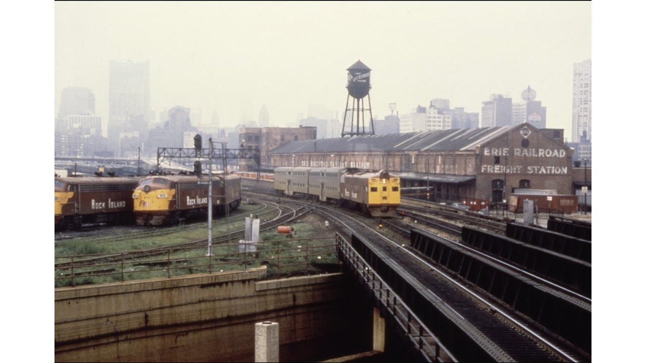
Source: John Szwajkart
That photo is looking north with LaSalle Street Station in the hazy distance. The Erie Railroad Freight Station can be seen on the right at the far south end of the Dearborn Station complex. In the foreground is the “C&WI trench” that carries Dearborn Station bound trains under the Rock Island (and New York Central) mainline. The connecting track is coming off the St. Charles Air Line. The turntable in question would be located just left of the photo.
Another photo looking east can be seen below. That is a superb photo that shows a number of interesting features. Among those features is the C&WI trench with a Santa Fe train departing from Dearborn Station, a Rock Island train departing LaSalle Street Stion and crossing over the trench and the three track spur coming off the Rock Island mainline head for the turntable.
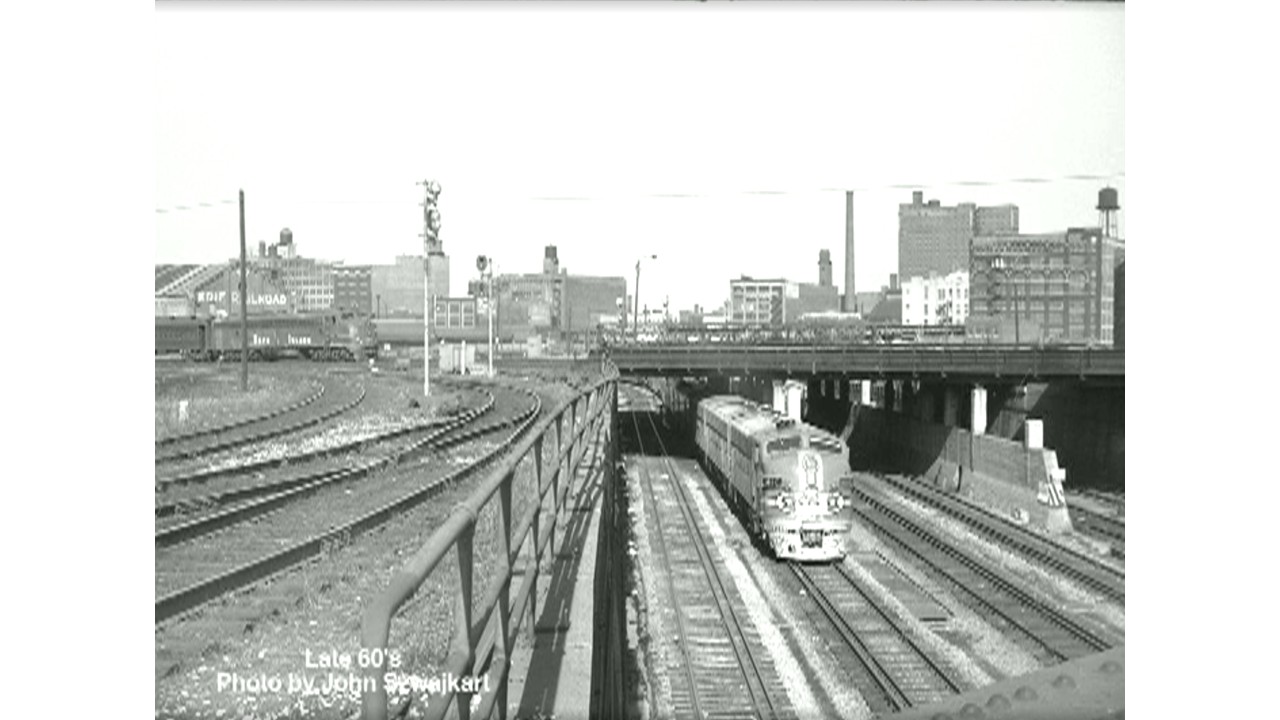
Source: John Szwajkart
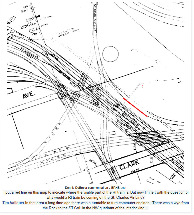
By the way, in a caption under an earlier photo in this thread, Dennis DeBruler commented that he was left with the question of why would a RI train be coming off the St. Charles Air Line? The answer is that it wouldn’t. LaSalle Street Station was shared by the Rock Island and the New York Central. Those connecting tracks from the St. Charles Air Line to the Rock Island mainline were used for interchange of passenger cars between the various railroads from the west coast and the east coast and points in between.
Rich
6 Likes
Good to see you back, Rich!
Ed
1 Like
I think it jibes with turning commuter power quickly, and the need for it might end with the advent of dieselization…
1 Like
Interesting photo shows the Rock Island box cab designed diesel pulling a commuter train. I don’t recall the type of diesel it is but it’s interesting.[quote=“gmpullman, post:26, topic:405654, full:true”]
Good to see you back, Rich!
Ed
[/quote]
*[quote=“gmpullman, post:26, topic:405654, full:true”]
Good to see you back, Rich!
Ed
[/quote]
1 Like
Rich, glad you’re back. You’ve been missed.
Regards, Chris
1 Like
Glad Your Back Rich!
1 Like
That “box cab” was an E6 B-unit specially built for RI. The Rocky Mountain Rocket split at Limon, CO, with the A-unit going to Denver, and the B-unit equipped with a cab could bring the Colorado Springs section to its terminal. Originally the loco had only one engine and a baggage compartment. The usual second engine was added when they went to Chicago commuter service.
1 Like
The “official” designation was AB6.
1 Like
Thanks, guys. I wasn’t planning to disappear, but I felt that I needed a break from the forum.
Rich
5 Likes
Exactly. I totally agree.
Rich
3 Likes
Hmmmm must be where pirates are hiding their treasure.
1 Like