I am helping a senior relative to bucket list 3 day ride on the Canyon Spirit this fall. Any advice, geography research, railfan hints, etc?
I have done some railfanning and HO modeled mostly Diesels 1940 to 1990.
First one I have; What is the most distant landmark visible during the Canyon Spirit’s ride?
SLC - Moab - Glenwood Springs - Denver.
Thanks,
rh
Here is a link for some helpful information: https://www.rockymountaineer.com/blog/introducing-canyon-spirit-new-rail-experience-through-american-southwest#:*
1 Like
Thank you.
I have the company’s brochures / sites but their AI answer machine just does basic tourist, it does not handle Ferroequinology of the railfan nature. It ain’t set for things such as where a heavy freight would add a pair of helpers to the rear. (It will be rough on me now that the Tunnel Motors are gone.)
rh
Some of the railfan points of interest starting from SLC are: Gilluly loops on the W side of Soldier Summit; Helper station at the eastern base of that grade at the aptly named town of Helper; Moab is on a short branch off the main line; Large yard at Grand Junction also where North Branch coal trains enter main line; Dotsero where Tennessee Pass line takes off (OS beyond Gypsum); small yard at Bond near where the Craig branch takes off; Moffat Tunnel; Big Ten loops.
1 Like
I will be doing all my railfanning from onboard the Canyon Spirit, so I am preview planning by using detailed FAA pilot maps (“Sectionals”) Denver, SLC, corners of 'Vegas and Cheyenne, downloaded pdf’s from the list
“Sectional Aeronautical Raster Charts GEO-TIFF Files” found at;
https://www.faa.gov/air_traffic/flight_info/aeronav/digital_products/vfr/
First place I noticed is Moffat Tunnel.
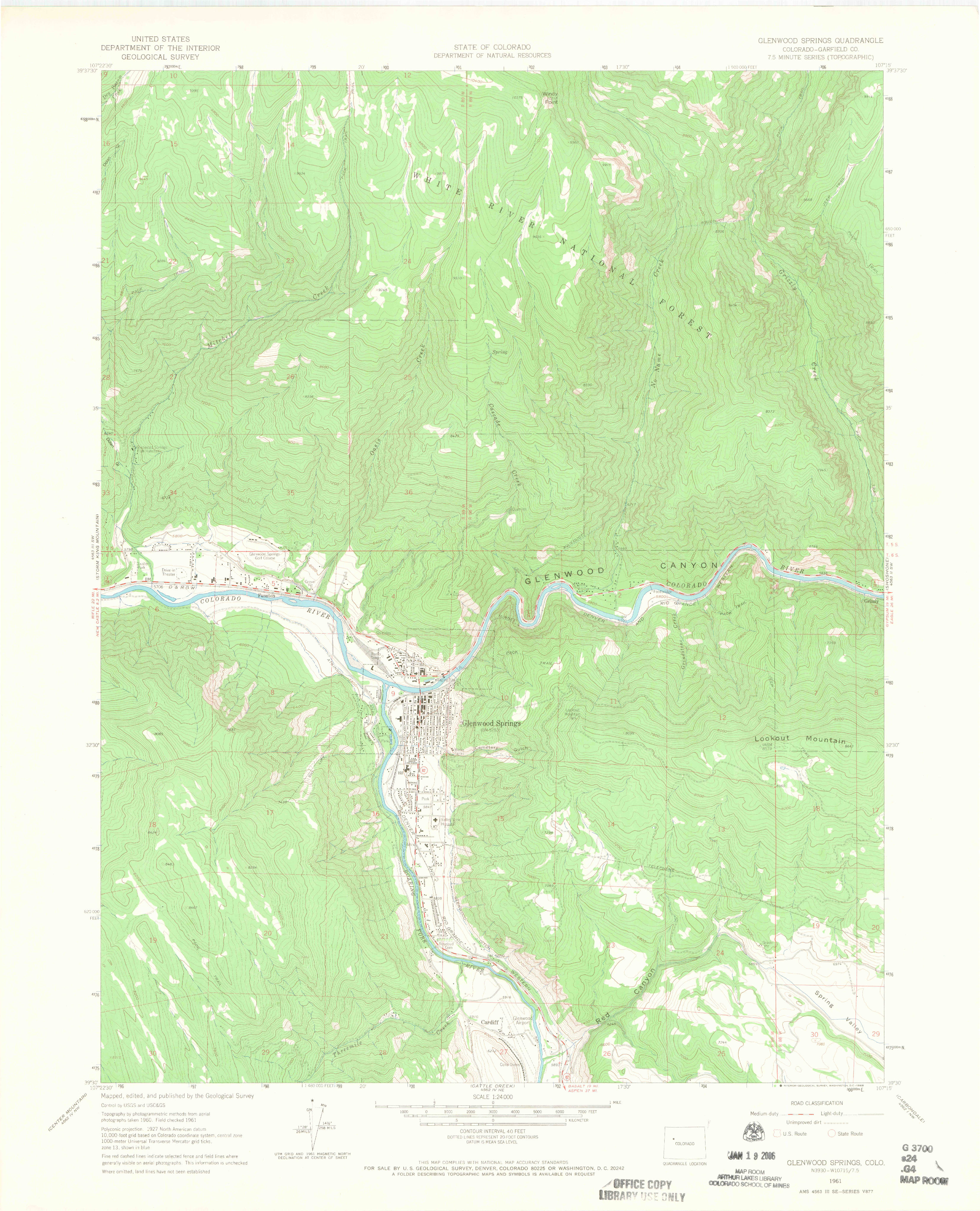
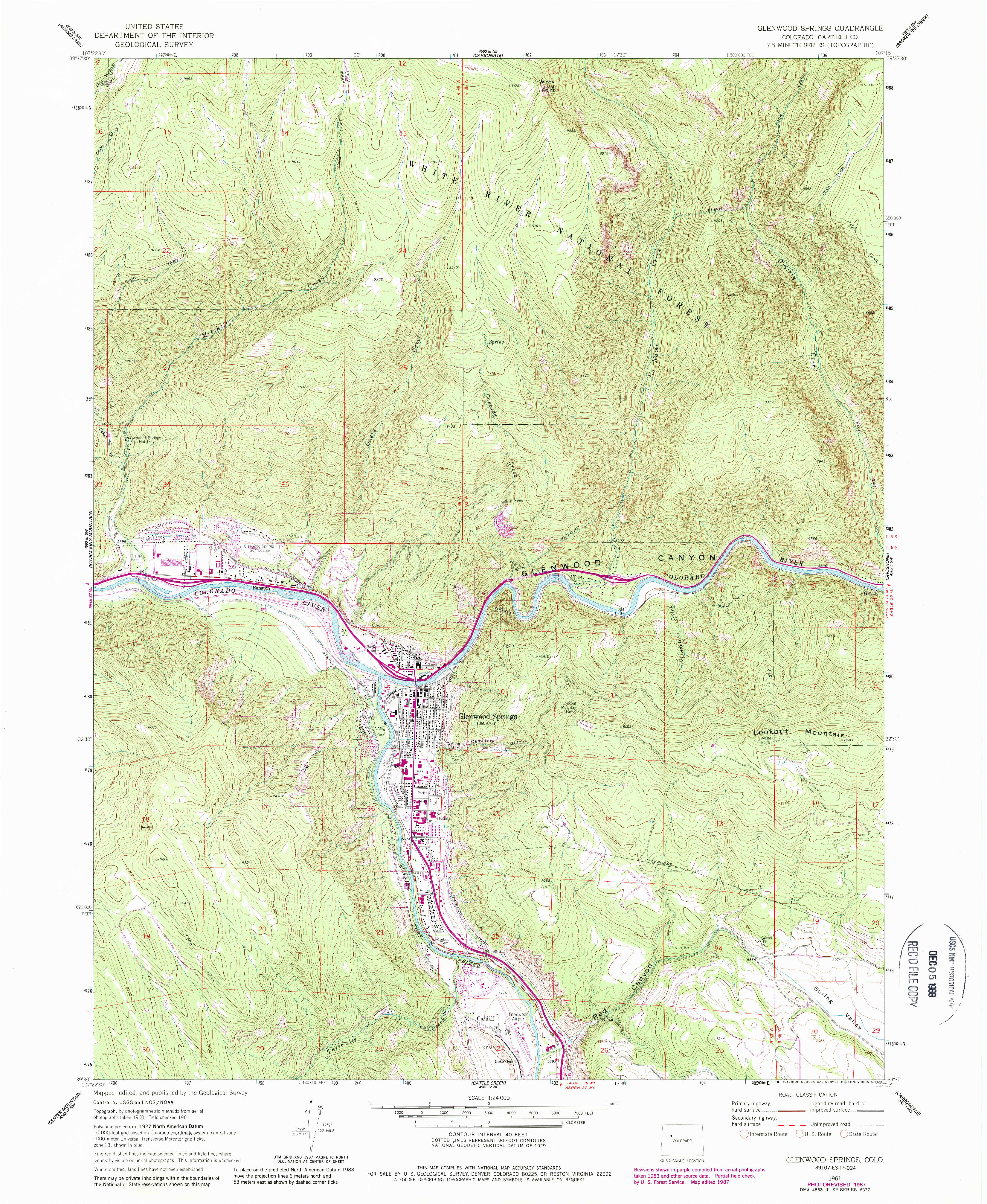
I assume that the air charts are up to date for air navigation, but they are out of date with regard to rail lines. The D&RGW line west of the Glenwood Springs station originally crossed the Colorado River from the south side to the north side. However, when I-70 was built, the rail line was moved to the abandoned Colorado Midland grade for several miles west.
Here is a USGS topo map before the interstate:
Here is the map after I-70 construction:
To see all topo maps:
2 Likes
Thanks for the help. Has anyone who has been on the SLC - DEN route ever noticed what is the most distant landmark visible from the RR?
A similar thought, is the viewing more scenic traveling from SLC to Denver rather than Denver to SLC? Like dropping down to Denver? And the window side of the car you’re looking from?
1 Like