Yikes, now that is a 100 year flood!!! Most Milwaukee Road Fans will recognize the iconic Milwaukee Road bridge in Wauwatosa, WI in the video below. I believe Jim Scribbins used to hang out there to take pictures of the Hiawatha back in the day. It was within a good rocks throw of the former Wauwatosa, WI depot (before it was torn down). Wauwatosa is a Western suburb of Milwaukee, WI.
One has to remember - when most all railroad routes were laid out in the 19th Century by surveyors on horseback - following water level routes was the way to route their lines, allowing the least grades as well as potentially the least grading in developing that route. Water is always close to most railroads.
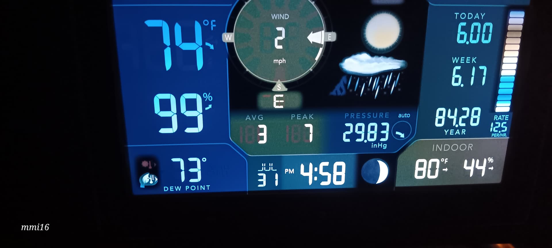
My home weather station - several weeks ago with an ‘afternoon thunderstorm’.
I don’t know how accurate 12.5 inches per hour actually is - but it was difficult to see a chain link fence about 30 feet from the window.
Likely a downburst. It’s easy to measure a rate that corresponds to ‘12.5 inches per hour’ for a period of a few seconds or minutes, particularly in a pop-up storm that starts losing convection at altitude before ‘lower down’, so all the condensed water in the column arrives during a comparatively short time. I have experienced the result twice while driving: you immediately lose any sense of what is around you, and you put on your hazards, steer for where you remember the shoulder, and hope those truck drivers around you don’t panic.
Is that “84.28” the cumulative precipitation for the year so far?
I am roughly 30 miles from Baltimore’s official weather station at BWI airport. The official total rain to date at BWI is 26.65 inches. That leads me to question how accurate my unit is in reality.
With all that being said - I am also about 10 to 15 miles from Ellicott City that had two catstrophic floods from similar kinds of afternoon thunderstorms - one in 2016 and one in 2018 where Tiber Creek which in relative terms ran down Main Street and over the years had become mostly covered thus restricting its capacity as it drains into the Patapsco River.
Thunderstorms in the Central Maryland are can be really local and really severe.
Weather patterns change over time. Also remember that we realistically only have about 150 years of accumulated weather monitoring data. There weren’t standards prior to the time frame. Accurate weather reporting really didn’t start happening until the mid 00s when we finally got the computing power needed to do every variation of the data plus better radars to monitor it. Doppler was the first step now they’re using phased array radars to get inside the storms. Also satellite monitoring improved instead of being slow to update the latest generation is real time monitoring of the weather.
Information is the name of the game and nowadays we have a lot more than we did just 30 years ago. BTW this year hasn’t been the worst flooding year in the Midwest that would’ve been 1993 in recent years second only to the 1927 floods.