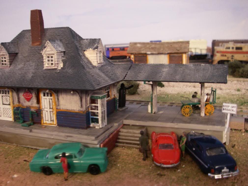
Yes, that is Darth Vader- he is choking a baggage attendant! MRR-ing is Fun!!!
Yes, that is Darth Vader- he is choking a baggage attendant! MRR-ing is Fun!!!
Whoops!
looks like Lunch is on Me! chow down!
Silverspike- here’s another Star Wars Character… Guess who?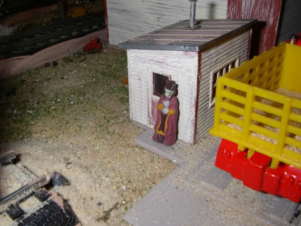
I’ll give you a hint: He’s in episodes 1-3
Inch,
You might not know it but I think you captured the actual 1968 merger of the PRR & NYC forming the PC railroad in you pictures!
I count 4 locomotives in your pictures a PRR 2631 + NYC 250? = PC 3239 & 3204.
…WINTER STORM WATCH REMAINS IN EFFECT FROM TUESDAY MORNING
THROUGH TUESDAY EVENING…
Tonight: Periods of rain, snow, and freezing rain, becoming all snow after 3am. Low around 34. South wind 6 to 9 mph becoming east. Chance of precipitation is 100%. New snow accumulation of less than a half inch possible.
Tuesday: Periods of snow. High near 36. East wind 10 to 18 mph becoming north. Chance of precipitation is 90%. New snow accumulation of 4 to 8 inches possible.
Tuesday Night: Snow showers likely. Cloudy, with a low around 18. Blustery, with a north wind between 23 and 26 mph, with gusts as high as 37 mph. Chance of precipitation is 70%.
Lee
Hey, great! I’m hungry!
Chloe, the Lobster and Shrimp Bisque…

with a Moxie…

and we’ll chase it with some Key Lime Pie!

Good afternoon.
It’s currently 71 here under partly cloudy skies. Expecting a high of 79. It’s already quite humid.
[b]
Today’s Weather for:
Sundown, LA 71446-6114 2/25/2008
Wind Chill: 69°F
Humidity: 71%
Dew Point: 59°F
So Far Today
High: 71°F
Low: 48°F
Rain: 0.01"
Rain Rate: 0.00"/h
Gust: 22mph SW
Rest Of Today High: 78 Increasing clouds. Highs in the upper 70s. South winds 10 to 15 mph.
Tonight Low: 48 Mostly cloudy. Slight chance of showers and thunderstorms in the evening…then chance of showers and thunderstorms after midnight. Lows in the upper 40s. Southwest winds 10 to 15 mph shifting to the northwest after midnight. Chance of precipitation 40 percent.
[/b]
**OzarkBelt:**Its the viceroy in charge of the naboo invasion.
Milk and cookies as a snack please. [:D]
Eventually. It wasn’t to go together as well as I would hope. But in this incarnation it’s gonna just hum a few bars as HO&N headquarters. To do all the other stuff, I =don;t think I;ve got the room. The thing I put up ysterday was more a mockup for the ultimate layout. I ogt a chiro adjustment, it’s helped the throat some. But we’re getting our second round o’ bugs too.
Good afternoon all. And goodnight. Snore
Afternoon all.
It’s sunny, and 55 or so degrees, which I find pretty nice.
I’ve been reading a great series of books lately. The first is Lightning Theif, 2nd is The Sea of Monsters, the 3rd (The one I’m reading now) The Titans Curse.
They’re all by Rick Riordan.
PC: I still have the card. You can have it back, along with 20 pies of your choice to keep Vinnie out of it. Okay?
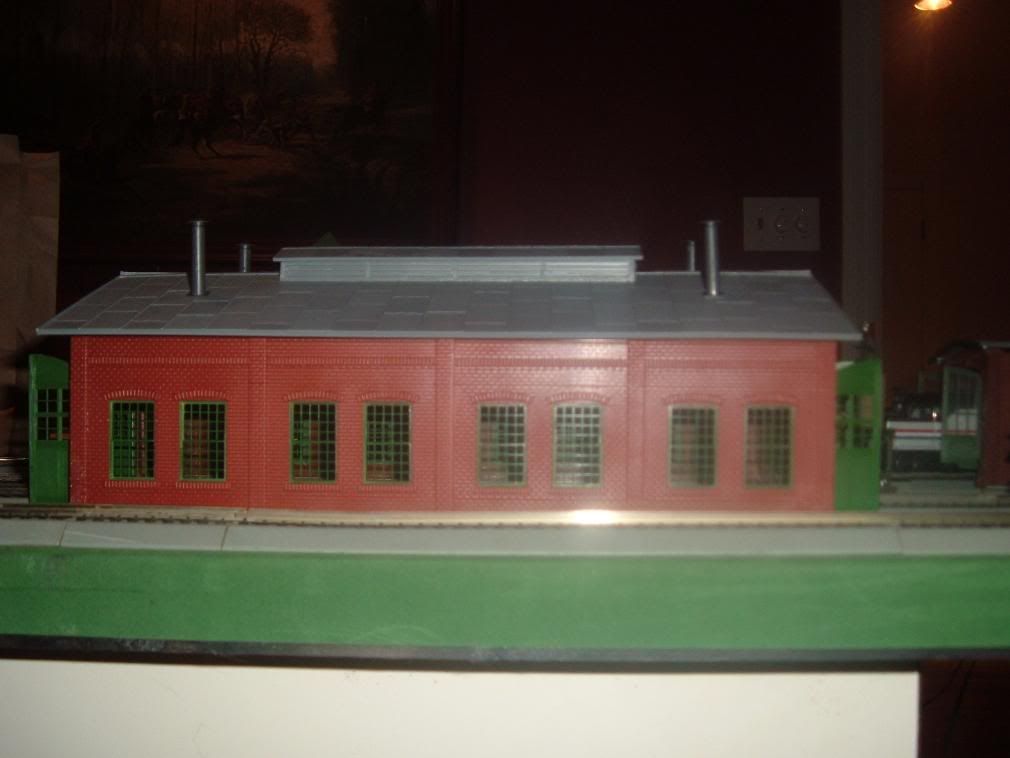
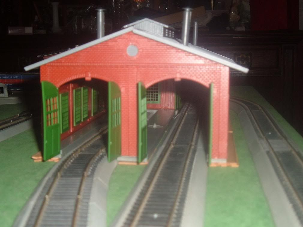
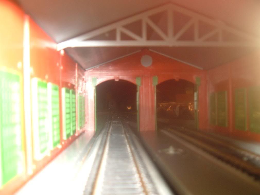
Flashwave: I like the engine house. Who makes it? I think I want one…
Rob: I still can’t seem to get a cornfield meet going. I’m working on a new route, and maybe with a long stretch of tracks, a hill, and some muscle, I can get the ES44’s to die.
Later.
Mark
 & the Grilled Halibut, please & thank you!
***Terry, I would LOVE to take that TT off your hands. Thanks! Will pm, you later.
***JP, will also pm you with the matchbox numbers (and photos later).
***Mark, I have faith in you figuring out some way to make a colosal crash!
Wifes sick friend’s mother may have just had a heart attack and she wants me to go with her to the hospital. (I would really rather not, as I had much to do tonight & the wife SHOULD be RESTING with that pneumonia) [:-,]
Good Evening Coffee Clubbers,
Another beautiful day down here in Paradise. [8D] Another warm one outside, but the a/c kept it nice here inside. They’re actually forecasting a ‘cool front’ to come through tomorrow night, maybe bringing some rain and dropping temperatures all the way down into the 50’s!!! I should be so lucky.
I’ll be off line for a few days starting Thursday evening. We’re heading up to Mexico City for a few days. Saturday we have another of our railfan outings, a one day bus tour following one of the lines heading west out of the city then turning north. Since we’re going that far for the railfan trip, we’ll stretch the trip out for a few days in the big city and do some shopping and sightseeing too.
Today’s adventure in haute cuisine involved fixing up a batch of the old Oahu Railway’s famous “Hawaiian Luau Pork”. [C=:-)] Okay, so it really wasn’t a recipe of the Oahu Rwy, and it’s really not even Hawaiian. But it does have pork, veggies, and pineapple, served over rice. Even Jr liked it, which surprised the heck out of me.
And the big news is that… well, after a lot of backsliding and procrastination, I finally took paintbrush in hand and completed painting the ties in the small section I’m working on. After giving them an initial coat of brown, I went back and dry brushed them with a light grey. It may not look right to others, but I’m pretty satisfied that it approaches the weather beaten look that I’m trying for. They certainly look a lot “softer” than the harsh look that the black plastic of the Atlas flex track usually gives. We’ll see how well it combines with some ballast later this week. Here’s a look at the ties in the part section looking from above.
Great! I have homework![:(!]
Yes, another Coke sounds great.
***Ed, track looks good.[tup] Also enjoyed seeing everyone elses recent work photos.
Well, Stan’s mom died. She was like a “second mother” to my wife, so my wife is pretty upset by this. Stan and his sister are naturally both in shock. I’ve been there…nothing else to say.
Good night all. [C):-)] Rob
eveninng all won a bid on some bachmann n scale track didn’t like thge life-like track at all. If you ask me it was real $%^&y track . that and the 4-8-4 would not run on it too tight the new track is 11 1/4" radius and the otther was 9 3/4 hope thats enough of an enlarging to run it woould really like to see here run the4-8-4 with 16 wheel tender.
If i get her going on a track with out problems may look into taking shell off tender and repainting it and either putting Balitimore & Ohio on it or Southern.
Jim I’ve been mulitscale for a while I have some G and also Standard gauge from 1931.


Evening Gang: Talk about weird weather. It got up to 90f here today and tomorrow morning is supposed to be 30f. If this doesn’t give us all problems I’ll be plesently supprised.
Rob I’, sorry to hear about Stans mother. My sympathys to him and your wife and you.
Ed I like the track so far. I’ll be looking forward to the ballast also. I checked my E-mail and I’ll send the information as soon as I get off here. Before I get Jacks layout in the garage I need to clean it out. I may end up taking the basement layout and taking it up to the garage also. Since it’s modular it isn’t a real problem. I’ll just have to see how space and stuff plays out.
Garry I looked at your tutorial. Nice job describing your method.
Not much here today. While I was putting out hay I passed Mary Ann and stopped the tractor and waved her over. I opened the door and asked her to do me a favor. she said “what” and I said “Would you go and get my jacket? It’s getting a might cold in here.” She replyed with the look and said " Shut Up". I got to do that once in a while.
Well I am going to cut out and write Ed.
Good Night All
***JP & Terry, check your “pms”.
***RT, those are COOL.
***Inch, if I forgot to mention it, thoroughly enjoyed those pics of the accident.
[C):-)] Rob
Evening all -
Hope everyone in the Ohio Valley, New England and Northeast are stocked up on supplies for the next 24-36 hours. I see Lee was already under a Winter Storm Watch. We were too, until about 3pm, then the NWS put us under a Warning. If the forecasted track stays as is, we’ll get at least 6-12 inches, if not more (see below). If you ask me, it’s about time we got into the ‘Winter Weather!’ So far, we’ve had an above normal temp winter, and below normal precipitation wise.
Winter Storm Warning
URGENT - WINTER WEATHER MESSAGE
NATIONAL WEATHER SERVICE BINGHAMTON NY
315 PM EST MON FEB 25 2008
…HEAVY SNOW ACCUMULATIONS WILL OCCUR ACROSS PORTIONS OF CENTRAL NEW YORK TUESDAY INTO WEDNESDAY…
.LOW PRESSURE DEVELOPING OVER THE CENTRAL PLAINS WILL INTENSIFY AS IT MOVES ACROSS SOUTHERN PENNSYLVANIA ON TUESDAY…AND THEN TO THE NEW ENGLAND COASTAL WATERS BY WEDNESDAY MORNING. THIS STORM WILL BRING HEAVY SNOW TO PORTIONS OF CENTRAL NEW YORK TUESDAY INTO WEDNESDAY.
NYZ009-016>018-036-037-260415-
/O.UPG.KBGM.WS.A.0003.080226T1100Z-080227T2300Z/
/O.NEW.KBGM.WS.W.0004.080226T1100Z-080227T1700Z/
NORTHERN ONEIDA-SENECA-SOUTHERN CAYUGA-ONONDAGA-MADISON-
SOUTHERN ONEIDA-
315 PM EST MON FEB 25 2008
…WINTER STORM WARNING IN EFFECT FROM 6 AM TUESDAY TO 12 PM EST
WEDNESDAY…
THE NATIONAL WEATHER SERVICE IN BINGHAMTON HAS ISSUED A WINTER STORM WARNING…WHICH IS IN EFFECT FROM 6 AM TUESDAY TO 12 PM EST WEDNESDAY.
SNOW WILL OVERSPREAD THE AREA DURING THE MORNING TUESDAY AND CONTINUE INTO WEDNESDAY. TEMPERATURES WILL BE NEAR TO SLIGHTLY ABOVE FREEZING TUESDAY AFTERNOON WHICH MAY LIMIT ACCUMULATIONS ON TREATED SURFACES. HEAVY ACCUMULATIONS WILL OCCUR TUESDAY NIGHT AND WEDNESDAY AS THE SNOW CONTINUES. SNOW ACCUMULATIONS THROUGH WEDNESDAY MORNING WILL RANGE FROM 6 TO 12 INCHES.
A WINTER STORM WARNING MEANS SIGNIFICANT AMOUNTS OF SNOW ARE EXPECTED OR OCCURRING. THIS WILL MAKE TRAVEL VERY
Hello everybody …
Thanks again for the remarks on my thread about rock strata. I just updated it to include gluing ground cover into the rocks.
RT … I really like the old standard guage train. Looks like a real prize!
Rob … Sorry to learn about the bad news.
happy Model railroading
Evening all…Got light rain here…just stopped in for a diet coke before turning in…You all have a good night…Jerry
Good evening, I mean good morning,
Just started snowing outside.
Ed, those tracks look good. What era/location is your layout?
Rob, Sorry to hear about Stan’s Wife. Is that the same person that had the heart attack you were going to go see in your previous post?
JPowel, yea we were under the watch all day and now we are under a warning. We should only get 9" of snow over the next 24 hours unless the storm changes from moving east to moving south since the bulk of it is over Lake Erie. Good luck NY the storm will be picking up energy and moisture as it travels over Lake Erie.
Lee
SNOW ACCUMULATIONS BY DAYBREAK WILL BE ABOUT AN INCH EXCEPT A LITTLE MORE IN SOME OF THE HILLS. THE SNOW WILL INCREASE IN INTENSITY DURING THE DAY TUESDAY AND MAY BE HEAVY AT TIMES… ESPECIALLY IN THE AFTERNOON AND EVENING. BLOWING AND DRIFTING SNOW WILL DEVELOP BY LATE AFTERNOON. AN ADDITIONAL 4 TO 6 INCHES OF ACCUMULATION IS EXPECTED DURING THE DAY TUESDAY… WITH ANOTHER 1 TO 3 INCHES POSSIBLE BY THE TIME THE SNOW WINDS DOWN LATE TUESDAY EVENING. STORM TOTALS OF 6 TO 9 INCHES ARE POSSIBLE OVER THE AREA.