Mississippi River Crossings

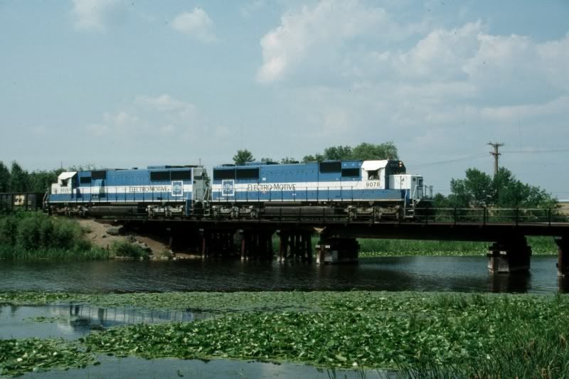
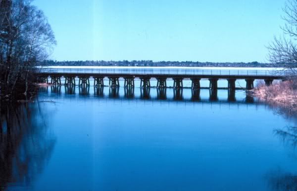
This Trackside Guide covers the 56 railroad crossings of the Mississippi River,
both currently in use or abandoned. Each entry has a brief history followed by links
to photographs and further information. Suggestions and corrections are welcome.

The Mississippi River starts at Lake Itasca in Northern Minnesota. From there it
runs north and then east before turning south and draining into the Gulf of Mexico.
I have numbered the bridges from 1 to 56 following the river, and these numbers conflict with official bridge numbers. The current length of the Mississippi is 2,340
miles. Back in 1940 it was 2,555 miles, as navigation projects have been
straightening the river’s course. I am not aware of any rail connection running east
and west which did not cross the river or the Canadian border.

Passenger service-
Amtrak currently uses eight of these bridges. The Ann Rutledge,

Wow…that was a lot of work.

What is your favorite bridge? Mine is the IC @ Dubuque with the curving tunnel.

ed

I really have not had time to compare them. I am really intrigued by the CMSP&P pontoon bridges (Wabasha#28 and Prairie du Chien#32). The Wabash bridge (Hannibal#43) has a curved tunnel on the west side. What I really like is that they are all different. Before July 31st they had just been names on a map.

Interesting study. The bridges in the Twin Cities are the ones I’m most familiar with.

I believe that #13 is called the Camden bridge, and is indeed CP’s third and final crossing of the Mississippi, for trains traveling west from Chicago. The first is just east of LaCrosse WI (#28) and the second is at Hastings MN (#24).

I’m not sure if #14 is in use any longer.

#15 is very much in use by BNSF for their Wilmar line, also the TC&W, and the UP for access to their customers in the west metro (ex C&NW).

#16 is James J. Hill’s famous stone arch bridge, which is now being used as a bike and walking path.

#17, there is no bridge, but there was many years ago. The Minneapolis & Western had a very tall steel trestle which I believe started near north end of the I-35W bridge, and crossed the river southwesterly.

#18 is the NP high bridge, still standing, but unused.

#19 is the Milwaukee short line bridge. Once a very vital connection carrying passengers and freight to Minneapolis and points west, it now has been reduced to single track, and is dedicated to serving the Hiawatha Milling District in south Minneapolis. I believe the Minnesota Comercial leases the track from the CP and provides the service.

#20 the Omaha swing bridge, is part of UP’s mainline to Mankato and Omaha.

#21 is also part of the UP now. It actually forms a large loop with #22 connecting in South St Paul.

#23 is an interesting bridge, but unfortunately is no longer in use. It Last served as a single lane toll bridge for cars, which used the lower level, while the tracks were on the upper. It has fallen into such disrepair, that it was finally closed to all traffic.

Thank you. That is most helpful. I hope to have this done before September.

You’re welcome.

UP’s Twin Cities trackage is rather interesting because it runs off in so many directions. Most of it came from the C&NW, but 2 of the 3 bridges came from different sources. As you noted, #21 was built by the CGW. It provided access to St Paul’s Union Depot for some of the lesser roads.

#22 was built by the St Paul Bridge & Terminal, which had yards on both sides of the river. My guess is that back in the day, they provided interchange service for all of the railroads in the area. On the west bank, the CGW, CRI&P, Milwaukee Road (who had tracks on both sides of the river). On the east bank, C&NW, CB&Q, NP, GN.

#20 the Omaha swing bridge is a little unusual, though you may not have noticed. It can be seen in the original linked photo(it shows better if you scroll south one frame). Most swing bridges have their pivots at the center of the span. This bridge has a large counter weight to allow for an off center pivot, making the shipping channel wider without making the bridge longer.

Here is a diagram of what UP’s track looks like today. See the loop?

On a related note, at one time back in the 30’s the Milwaukee Road considered building another bridge across the Mississippi near the mouth of the Minnesota River. This would have replaced a bridge that crossed the Minnesota a couple of miles away. My guess is that the resulting grade would have been more favorable than that of the old Minnesota crossing. Of course it was never built, and today the Minnesota bridge is long gone as well.

Bridge 36 is the double-decked ATSF span at Fort Madison. The Transcon uses the lower level and a highway toll bridge uses the upper level. Note that the navigation channel is closer to the Iowa side.

Apparently the bridge across Mississippi at Fort Madison is owned by BNSF, as the toll attendant was wearing BNSF regalia. It only cost a dollar!

Nanaimo, as long as you are making changes to the master list, I think #16 needs work. To say that it is just “another Great Northern bridge” is like saying the Great Pyramid is another pile of rocks. The Stone Arch is among the top 5 masonry railroad viaducts in North America, and perhaps the crown jewel of James J. Hills railroading accomplishments.

Part of what makes it such a spectacular engineering feat, is the nature of the river in that location. Just a few hundred yards upstream, the river plunges about 40 feet, at St Anthony Falls. The force of the water has demolished numerous man made srtuctures placed in it’s path, including a power plant, as recently as 10 years ago, yet the bridge still stands.

In the early days Minneapolis got it’s start because of the river. Companies like Pillsbury and General Mills owe their existance to the river, which was harnessed to power their first mills along it’s west bank.

In the early 60’s, the Army Corps of Engineers built lock and dam #1, and removed a section of the stone work replacing it with with a steel truss. This allowed comercial navigation to move about 5 miles north to the Port of Minneapolis, between bridges 13 and 14.

Here is a vintage photo of the Stone Arch Bridge, with C&NW’s 400 departing Minneapolis. Beyond the bridge are the mills.

I agree. Today I just wanted to get all of the locations down. I’m guessing I will spend about 30 minutes on each bridge on the history, something like 25 or 30 hours altogether. I don’t know how to do this at home and put it all on the forum at once. I don’t even know how to “cut and paste”. I’ll be working on the original post for two or three weeks.

I see, well cutting and pasting is really pretty easy. When you see text you want, hold down the left mouse button, and drag it over the desired text, it will be highlighted. Then right click while on the highlighted area, and a small menu will come up. Copy leaves the original in place, and makes a copy of it on the “clipboard”. Cut removes the original text. Paste puts the contents of the clipboard in at the cursor.

If you have a lot of cutting and pasting to do, just start a notepad file, and start dumping everything into it. Then move the chunks around. When you are ready, copy it all to the clipboard, and edit your post. Another option is to have your note pad file open in one window and the forum in another, and move chunks that way.

If you just want part of what I said, copy it. You don’t even need to use a quote.

Actually, you must know how to cut and paste. I can’t imagine you retyped all those links. Did you??? [swg]

BTW I have photos of a few of the bridges, and can get some of the others If you want.

That is an excellent study. Thanks for putting the time in to produce it.

Here is one of my shots of the BNSF crossing in Bemidji, MN

Dan

I was going to post that. Well, actually I still will. I love the Oakways. Do you know if the Soo bridge just to the north is still used ?

No, it is no longer in use. I’ve also got a shot of the old M&I bridge, that is now used for a bike trail, will post after I get it scanned.

Here it is.

Dan

Worked as Operator on Bridge at Sabula, Ia # 30 in Early sixties have fond memories of it . This would be my Favorite

Mike Beckert

I see you have been very busy working on the list. Lookin good.

I happened to be out and about yesterday, and managed to grab some quick shots of some of the Twin Cities bridges. They aren’t exactly simple to photograph when you’re in a hurry, because the best locations need to be walked to, and I didn’t have time.

One thing that makes the Camden bridge (#13) unusual is that there is a switch at the west end, at least 50’ from the bank. It can be seen very well in the aerial photo, but land based shots tend to miss that feature. This isn’t the best picture, but it does show how the bridge branches off.

Moving down stream, I was mistaken about the status of #14. The BNSF does indeed have customers on the west bank, including a cement plant and at least 2 scrap metal dealers. There may be more. The bridge was reduced from 2 tracks down to 1, but it is alive and well.

As I was heading down the road on the east side of the river, the road crossed over the line that leads to #15. Of course there was a westbound TC&W train, heading for the bridge, but by the time I could get to the spot where I could actually see the bridge, it had crossed.

I didn’t mess with the stone arch. If you look at the photo I posted earlier, in the background there is a concrete arch road bridge. That may be one of the best public vantage points remaining to shoot the stone arch.

This brings us to #17 which no longer exists. Here is all that remains of the Minneapolis Western bridge, the east bank approach footing. If you look closely through the other road bridges, you can just make out a small section of the steel trusses of the NP High Bridge (#18).

Here is what the bridge mi

Nanaimo, I find parts of this document to be suspect. I know that I am not always right, but I can guarantee you that Hudson Wisconsin is NOT on the MISSISSIPPI. It is on the ST CROIX. The St Croix forms the border between Minnesota and Wisconsin north of the Mississippi, and flows into it at Prescott Wisconsin, about 3 miles down river from Hastings.

The BNSF (ex CB&Q) main to Chicago crosses the mouth of the St Croix at Prescott, and enters Minnesota. There is really only one possibility for there to have been such a bridge 52 in this location, and that would be if a much earlier version of the Milwaukee Road had a very different alignment from present day. The problem with an alignment that followed the river bank more closely, opposite Prescott, is that it is mostly swamp and backwater. There was also the Vermillion River to contend with. Very difficult terrain for a railroad to cross, especially given that there was good solid ground a couple of miles inland.

It is possible that there was an earlier version of bridge 24, but I can’t imagine that it would have been very far from where it is today. Then there’s the question of what railroad did it belong to?

Yes, I agree with you. I’m going to check it out on
http://memory.loc.gov/ammem/gmdhtml/rrhtml/rrhome.html
when I get time. I wanted to raise the question for other investigators. I looked around on Terraserver and couldn’t find anything.
http://terraserver.microsoft.com/image.aspx?T=1&S=12&Z=15&X=644&Y=6192&W
The year given in that link (the one in your quote works) is 1871.

You mentioned St. Paul#24 and Hastings#27 were the only lift bridges you knew of still operating. The Wabash bridge, Hannibal#43, is another.

Was Minneapolis#20 the Minneapolis Western or the Minneapolis and Western ?

That is a cool resource. I didn’t plow through everything yet, I kind of went straight to the earliest. The first one only had a single line heading west from St Paul along the east bank, and finally crossing near St Cloud. (circa 1850) No connections to the east.

The next one skipped about 40 years ahead, and showed the lines pretty well developed into their maximum configuration. Unfortunately, I can’t link directly to that map (I tried), but it shows the tracks in their current orientation, though the map is rather crude.

I suspect that the 1871 documentation was referring to the bridge at Prescott which crossed the St Croix to a piece of land in Minnesota called Point Douglas. To someone not familiar with the area, they wouldn’t really know the difference, and those are the two closest towns. I still don’t think we have a “phantom” bridge.

Your teraserver link captured that bridge perfectly, though it is hard to see because it is so dark against the water. The light colored road bridge just to the north stands out much better. The Perscott bridge too is a lift bridge.

Sorry I didn’t notice #40 as being a lift. I’ve been a little too focused on the Minnesota bridges, but as you have posted additional photo links, I have been looking at the others down stream. Kind of hard to tell a lift from overhead.[;)] ED. Now that you mentioned it I see the shadows of of the lift towers on the water.

I am by interest more of a modeler than a railroader, which is part of the reason these bridges interest me so much. On my home layout, I will be representing Hastings, Prescott, and the Milwaukee Short Line, for sure (maybe others).

As you can see from my signature, the focus will be the Amtrak Empire Builder, though that would get rather dull with only 2 trains per day, so there will also be plenty of freight.

The layout starts out on the south end at Red Wing on the CP, with a second leg entering at Prescott on the BNSF. The plan