One area on the future Perris Valley Line (PVL) route is mountainous, in the Box Springs area, as previously shown.
The Environmental Impact Report (EIR) and known project details mention a lot of earth moving north of that above pictured area. However, K.P. knows of no specific details about such, but likely that earthmoving will be done to make a higher speed route through what is now freight train negotiated at a relatively slow speed.
… just how curvy that ex-California Southern 1882-1883 track-laid north-south route is, a route that went from San Diego to Colton. No major relocations that K.P. knows of have ever taken place in the Box Spring area before now. Of course, part of the inspiration for any route relocations died in the early 1890’s when the through route was severed and abandoned because of massive flooding and severe washouts between Perris and Oceanside.
This post series is intended to show several relocations that have taken place on other routes in
Circa 1976 major line relocations took place on the Santa Fe in Cajon Pass, some of them on the actual California Southern route that came up from Perris and through the Box Springs area discussed in the previous Part A.
That relocation is seen in the distance on the upper left of the below never before shown to the TRAINS Forum photo:
Down by Cajon, in 1913 a second track was laid over Cajon Pass, and went over the bridge cement-work on the far right of the below view:
The 1913 line was relocated to its present location in the 1970’s, because of what K.P. believes partially caused a train wreck over the now abandoned culvert-work above.
In 2008 the second-track on that “north” side route was laid, making three-tracks over Cajon Pass.
It should be noted that line relocations and adding additional tracks on Cajon Pass was done with railroad funds, and not public money. The Perris Valley Line is being rebuilt to commuter train standards and stations built, all with a quarter of a billion dollars of public money!
In the Marsh Station Rd. area near Cienega Creek east of Tucson, AZ, Union Pacific’s former Main 2 (now of a radically different designation) was rerouted. Here, some then preliminary views:
Many moons ago in the Anschutz era of Southern Pacific, Metrolink (the outfit that now owns the trackage of the future Perris Valley Line) purchased what is now the Antelope Valley Line between Los Angeles and Palmdale.
In the above photo, the south end of the Quarts-Crest siding wasn’t always that way, but the siding was extended to the way it is now. Under Southern Pacific, this Main and siding situation was a section of “Double-track” (not two-tracks) and involved spring switches.
Metrolink revamped the already excellent route, relocating some trackage.
The old right-of-way is barely discernible about midway up in the below photo.
On the right, the old, trackless right-of-way comes to the left center of the photo
Above, autos and the Sierra Highway are seen in the background. Also, the line climbs left to right.
The old right-of-way cut shadows are on the hillside, just left and slightly below center.
Barely visible on the lower left, the Antelope Valley Line is seen. The freeway in the background is Highway 14, along with the Metrolink track route, goes through a scenic, very mountainous area.
A number of views of the Vincent Grade - Acton Station stop.
While this stop has been in operation for a number of years now, the site has matured to many trees, and a certain quaint attractiveness about it.
While the station stops on the Perris Valley Line have Environment Impact Report parking lot drawings about them, it is unknown exactly what type of buildings will be present for its station stops, nor how much grading for them will be necessary
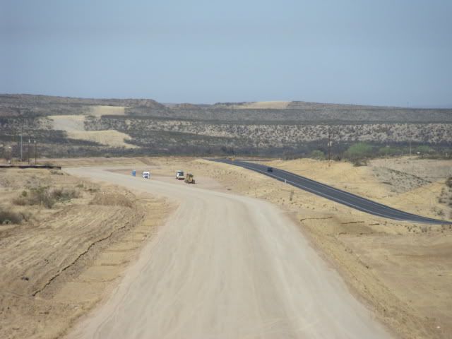
The Perris Valley line is supposed to have a massive amount of dirt moved in the Box Springs area for the relocation. (The below photos were previously shown.)
So, earthmovers have been in a number of locations in California and Arizona over the years. We can expect the Perris Valley Line to be next!
Thank you for these neat set of photos from the Antelope line. The Vincent Grade/Acton station is one of the more unique stations in the Metrolink system, to be sure!
I wonder if the people who live near the railyards in Commerce, or under the flightpath of LAX, have much sympathy for the Friends of Riverside’s Hills. I doubt it.
The Press-Enterprise’s website keeps putting out different versions of the court decision news, a kind of update on the update.
Sometime today the Riverside County Transportation Commission (RCTC) is reported to be having a closed door session to figure out what they are going to do.
There has been an update with regards to the court proceedings of the Perris Valley Line: Riverside County transportation officials will be in court on Wednesday.
Forum contributor mvs recently alerted us to the news that Wednesday, April 24, 2013 supposedly the parties in the lawsuit will be back in court. Little is publicly in print about the matter. Two-thirds of the original judge’s ruling favored Riverside County Transportation Commission’s (RCTC’s) side, with only a third for the Friends group. While K.P. is not an attorney, in his opinion what is taking place is a delay tactic by the Friends group that may or may not bring about success for unclear motives. There may (“may”) be a resolution tomorrow, but if the parties are entrenched things could linger on in appeals.
More about the Line from a Passing By
Part I (of I-V)
On Monday, April 15, 2013, a few select areas of the line were focused on and photographed for the forum. Below is a selection of the results.
On March 11, 2013, the in-storage well cars were photographed along I-215, the SOUTH cars of which are seen by the advertising sign on the far left of the below reshown photo.
On the April 15 visit, the south end had been moved southward a bit to around the curve, towards downtown Perris.
Out of Perris northward a few miles, the southern of two track relocations is present, necessitated by the I-215 Freeway reconstruction a few years ago, at least that option was chosen by the designers.
Looking southbound:
Originally, the line did not curve (above photos’ bottoms) but went straight.


