Hmm-- good points. I’ve been thinking about it more this morning, and you might be right. I don’t want to hide the climb per se, but I’d like to push it into the “background” as much as the actual space and “perspective tricks” will permit me to achieve. I want the foreground scene to be the predominant scene and interest. With that in mind, my goal is to weave the climb in / out of tunnels and so forth to hopefully minimize its presence as much as possible without completely eliminating it.
Some more good points. Hopefully I will have some time this week to get the room cleaned up and the benchwork set back up. Then I can pull out some cardboard and masonite strips and mock it up a little. I think that will help me get a better feel for what I can do and what I can’t. I’ve done it on the CAD program, so supposedly it will all fit right, but I’m having trouble just “visualizing it” in my mind and while I’m down there-- but I reckon that’s not the worst problem. The track will have to go the way it goes. There will be a bit of leeway I suppose in how it can go, but ultimately its gonna have to swing back around the room to climb to the upper deck. Only so many ways that can happen. I’ll just have to work around it.
Thanks everybody for their thoughts and suggestions. If anybody has any more, please chip in, I’m all ears!
OK, guys, in geology there is a little thing called “the angle of repose”. This determines the steepest angle a mountain’s, or hill’s, sides can maintain without sliding off. Obviously, when composed of solid stone, this angle can be quite considerable. But in the cases of most types of dirt/soil, the angle is under 45 degrees.
Since the Appalachians are basically dirt-covered, the steepest angle normally encountered (even with vegetation to help hold the dirt/soil in place) won’t exceed a 40 degree incline and often will be no more than around 30 degrees. The exception to this would, of course, be terraced areas that are a combination of rock outcroppings and soil.
However, as a previous poster indicated, in the application being suggested the viewer is looking up hill at the mountain face-on and the actual slope would be hard to ascertain accurately. Thus, you could likely get away with an incline of about 40 degree without it looking abnormal.
Limited space and the compression that it forces often results in terrain that you wouldn’t see in the prototype. It’s a necessary evil in the world of models.
Since the Appalachians are basically dirt-covered, the steepest angle normally encountered (even with vegetation to help hold the dirt/soil in place) won’t exceed a 40 degree incline and often will be no more than around 30 degrees. The exception to this would, of course, be terraced areas that are a combination of rock outcroppings and soil.
John.
John,I have lived worked, and hunted in Eastern Kentucky and I will tell you upfront 60 degree incline is not out of the question in some areas.Also a lot of them thar hills has a rocky ground.Eastern and Southern Ohio has the same inclines and those are just the foothills of the Appalachians.
If you fail to believe that come with me to those foothills and see for yourself.
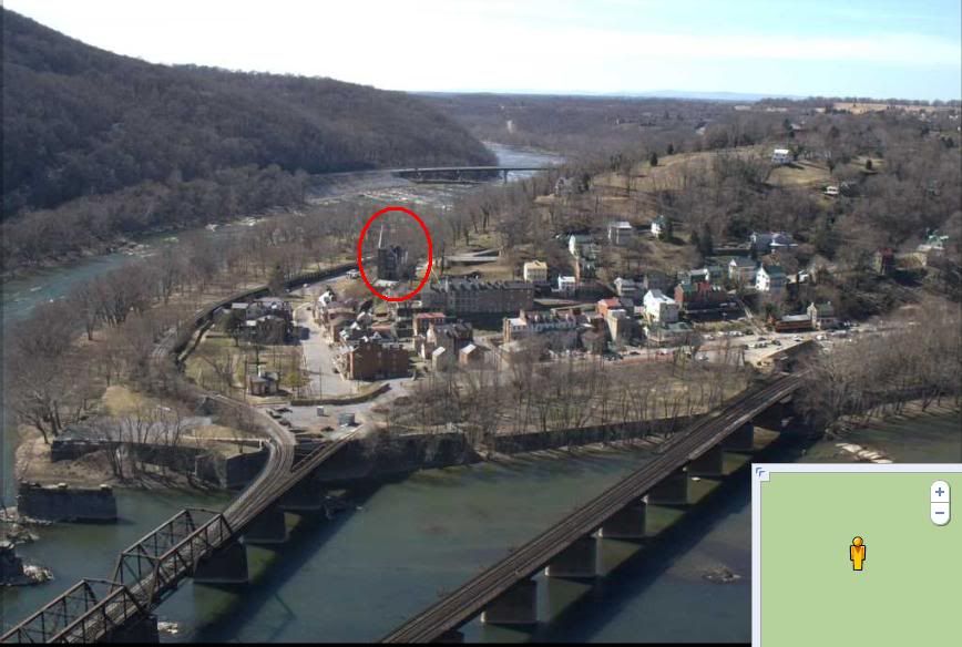
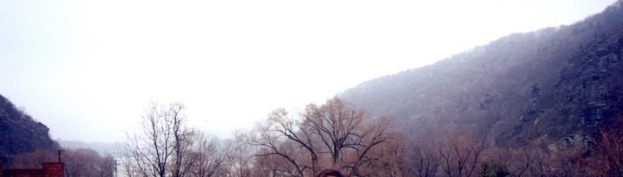
Slope can be highly deceptive. For example this picture in Harpers Ferry WV, this town looks relatively flat. But if you compare the roofs to the foundations of the buildings near it, you can see it climbs 3 stories in a relatively short distance.
I don’t care whether you are in the Rockies or the Sierras or the Appalachians (I have lived and hiked in all 3 areas now), more than a 30 degree slope is not the norm. It just appears much steeper than that to our eyes. A 45 degree slope cannot be walked; it’s on all fours - and usually called rock climbing.
But don’t take my word for it - measure the rise over the run on topographic maps. Then take the arctangent to find the angle. The most common place where the 30 degree rule is exceeded in nature is not the peaks, but creek and river valleys and gorges - and geologically, those tend to be relatively unstable slopes.
I was exploring the Black Canyon on the Gunnison River in Colorado earlier this Fall. I asked about hiking down to the river. The easiest chutes had slopes averaging 2000 ft/mile (a common measure of trail steepness in Colorado), which is a 37% grade or a 20 degree angle. At that average steepness, you are on all 4s on the steeper parts. That was too s
I’m sorry, I disagree. A 60 degree slope rises 17ft for every 10ft horizontally. Doesn’t look close to that in the photo, even with the horizontal fore-shortening of the telephoto lens. You’ll have to show me that’s it truly a 60 degree slope from a topo map where the horizontal spacing of the elevations has been done to scale.
The eye is easily deceived into thinking angles are much greater than they are. Because we don’t realize our inner ears can detect less than a degree offset from equilibrium, we exaggerate in our minds what we see. In flying helicopters, if I laid in a mere 45 degree angle of bank - balanced turn so that gravity was still centered for you - and had the door open with you looking at the ground, you would swear I had the helicopter rolled over on its side.
Let’s try an easier example. A stairway in a house is almost always less than 45 degrees. Measure the rise over the run of your stairs, and compute the angle. Now put a piece of plywood on the stairs and try to walk up the plywood. Compare to your walking/hiking experience in the field.
If you still don’t believe, set the piece of plywood at a 60 degree angle with suitable risers, and try to walk it. For an 8ft length of plywood, you need an 83" riser at the high end.
FWIW, I have hiked sections of the AT in Virginia. I grew up in Northern Virginia, and I spent lots of time in that stretch of the Blue Ridge and Alleghenys. I’ve canoed stretches of the Shenandoah and Susquehanna Rivers. I travel I-40 between Nashville and Black Mountain NC (where my mother lives) pretty frequently. I have vacationed on Dale Hollow and Watuga Lakes and rafted the Nantahala and French Broad Rivers. The biggest difference between those areas and Colorado is not the terrain, but the altitude (leaves me gasping for air at 11,000 ft if I’m not in good shape) and the humidity (lack of in Colorado).
Larry, on the face of it ('cuz that’s how we see that slope and it is therefore impossible to estimate the true slope), the slope depicted there looks to be about 10 deg at the base and rising to maybe 40 deg at the upper third.
When I spoke of rock tors that I can see across the Strait of Georgia, I mean things that look like shark’s teeth standing on their bases. Even steeper.
Larry, regardless of the labeling accompanying that image, that slope clearly cannot be much more than around 30 degrees in angle. Were it anything close to 60 degrees, no more than the very tops of the more distant trees beyond the crest of the hill would be visible at close range. Even the steepest part of what is shown is only a brief rise in the terrain, not a typical large hillside and much less than 60 degrees in incline.
As to hiking various inclines, as already indicated by others, a 60 degree slope could not be climbed other than with considerable difficulty hand over hand, or better, yet with climbing gear!
Let’s all met in Ashland,Ky around June and we will hike them thar hills and I will show you 60% inclines.When we finish there we cross into W. Va and I will show you more and finally we will cross the Ohio River into Southern Ohio and I will show you more.
Are you game for some serious hill climbing?
In the mean I know how steep those hills are since I have lived,worked and hunted there.
This is what I am talking about. This is in the Rockies, in the Fraser River valley along the CP lines. The slopes shown here, even though shale and scree covered, are underborn by tough granite. You can see that they approach 45 deg. It is a very tough scramble up this stuff, and by no means a mere hike.
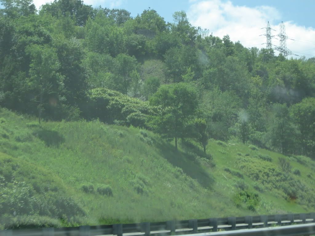
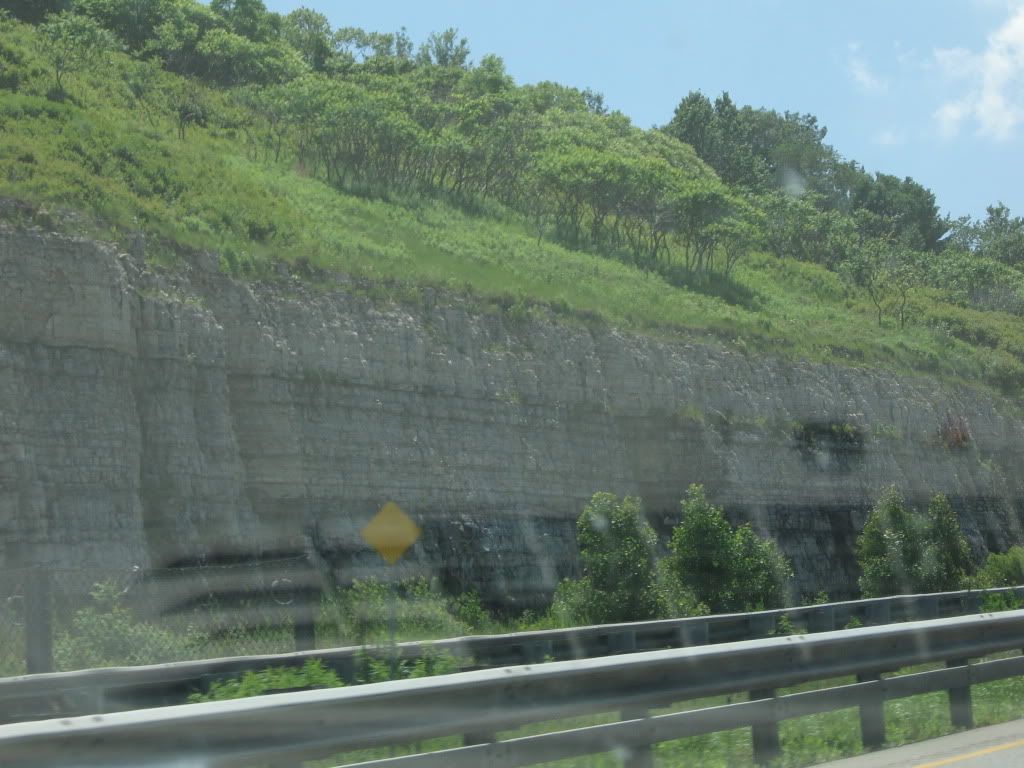
The following was taken on the susquhana in Pennsy terratory just north or Harrisburg Railroad tracks follow this river. So this is a typical grade for the PRR.
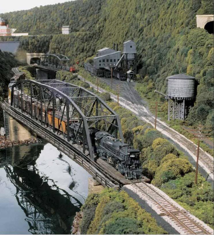
Hmm-- while the scene is a bit different, the look and climb in the background is close to what I have in mind. Thanks for the photo. I’m gonna save it and print it out for inspiration!