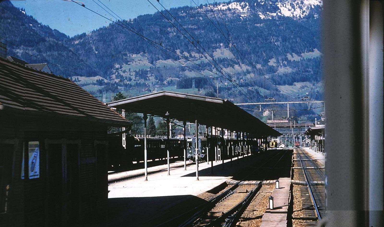
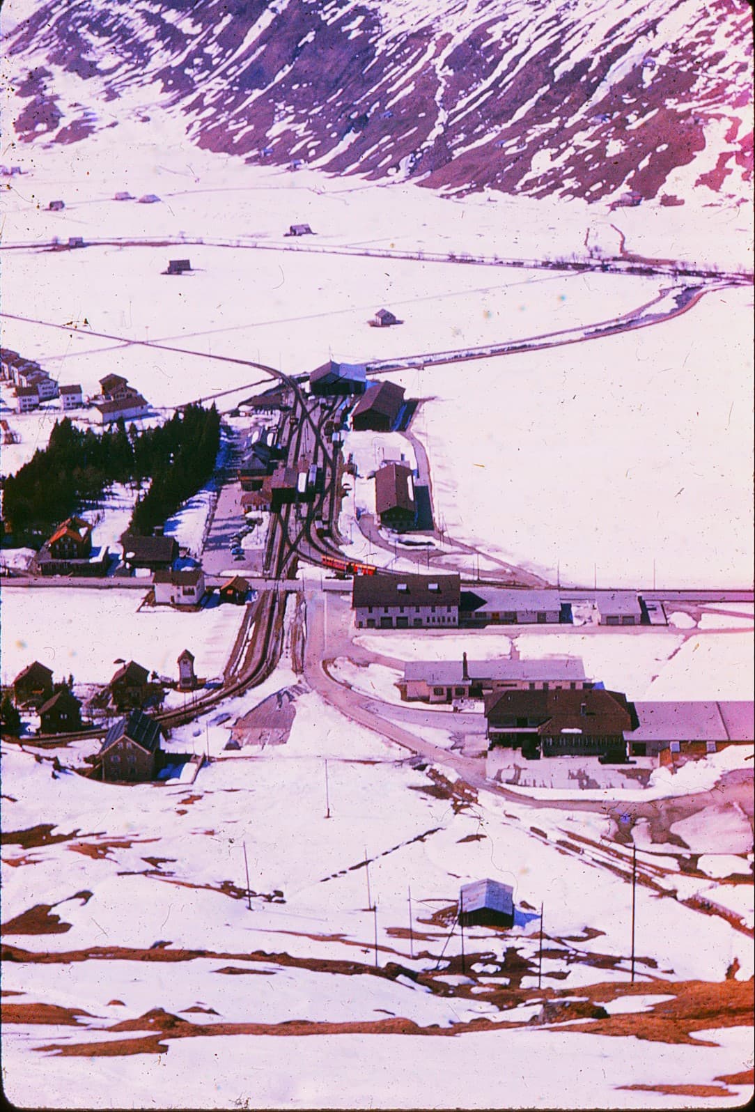
The station with both Meter and Standard gauge is Chur, I believe, and seemingl airial view is looking down on the junction town at Arosa at the south end of the old Gothard Tunnel, taken from the cog railroad that climes to a connection wth the Furka Overalp at Andermat (?), (If I have time, I’ll do the map research and further correct this thread. Or a reader can help. Includinhg other photo locations.)

2 Likes
I believe the ‘junction town’ is Brigue (some of the signs there just spell it ‘Brig’ as the language changes across the tunnel).
I thought of Brig also, but it’s at the north portal of the Simplon Tunnel. Google satellite view of Brig does not look like the photo. Also the Rhone River runs along the tracks in the present areal image. Of course a lot of things could have changed in 60 years since Dave’s photo. The south end of the tunnel is in a narrow valley.
Not only a number of things changed but also a very different photo location. Remember the mistake I ma\de regarding my image of the LIRR Long Island City Terminal, and the mjssing Manhattan sky-line, missing becayuse the view is west-pto-east, and not because of photo defects.
But to resolve the issue, I rode standard-gauge Swiss Federal train south from Lucern. So it must have been the Gothard Tunnel, not the Simplon, which I used on my earlier Swiss visit in 1960.
And the south end was Ariolla. certainly not Brig. Now that 1882 Gothard Tunnel , still in use in 1960, has been bypassed for express trains and freight, by a longer Gothard Base Tyunnel, Tunnel, Ariolla is more isolated, and apparently the Ariolla-Andermat direct train no longer operates, and travel by rail requires return to the tunnel’s north end at Goechenen.
But I’m not completely certain that the juction of the cog with the Furka Overalp was at Andermat.
It, too, on the meter gauge, may have been bypassed by tunnel.
Brig is German speaking, unlike most of Wallis/Valais, hence the German form is usually used. The areas up towards the south and east are also largely German speaking, while most of the rest of the canton is French speaking, with pockets of German.
The Furka-Operalp Bahn operated from Brig via Andermatt UR (junction with the Schoelennenbahn, part of F-O since 1960) to Disentis GR. The central stretch west of Andermatt was removed and re-installed each year until the opening of the Furka Basis Tunnel in 1982. Since 2003 the F-O and the former BVZ are united in the Matterhorn-Gotthard Bahn.
The BVZ (Brig-Visp-Zermatt) headed up the Matterhorn from Brig, though not, of course, all the way to the top.
I think the photo might be of Landquart, near Chur, which is the main transfer station for Davos. All of the towns mentioned have changed so much in the last 60 years that it’s difficult to compare the photo with current maps.
2 Likes
Additional information (corrections) posted.