Sunset Route Two-Tracking Updates

I was out in the Pomona area in August 2007, when I rode the Metrolink mid-afternoon run (that runs on the Salt Lake route) from LA to Riverside and return. I was able to get a pic of the graded right-of-way for the Sunset route relocation in the area. This view faces west.

Concerning MP57313’s Pomona, CA great photo above taken from a Metrolink commuter train, you may want to compare it with a mapquest.com aerial. Because of copyright infringement laws, you will have to take the long way around to view it, and instructions for doing so are outlined as follows:

If you double click on the link below, one will bring up a mapquest.com aerial of the reroute, but you have to scroll down to it.

http://www.mapquest.com/mq/4-Z8rZ

The star on the map is at the intersection of Big Falls Drive and Happy Hollow Road in Diamond Bar, CA. About an inch directionally northwest of the star, click the mouse, and the view will center on the reroute trackless grade. On the left side of the screen, vertical rowed size buttons are displayed, with probably the fifth button lit. Click on the fourth button down from the top, and a good view of the new grade will be displayed. (Do not use the first three buttons, as old, out of date, non-applicable aerial photos will be shown.) Take a good look, and enjoy …

The unusual cement work on the bottom of MP57313’s photo above is a bridge over the South San Jose Creek’s route. That bridge and creek are easily identified in the upper right of the mapquest.com aerial view.

The tr

FIRST of Two Posts:

All photos herein were taken April 13-14, 2008 …

Arizona**: Yuma to Maricopa**

Generally, substantial activity begins around MP 914 in the east and continues west to almost Maricopa.

Near M.P. 914, looking east

Looking west

Drainage construction at Bon

Bridge and culvert staging area at Bon

</

Now there’s an interesting idea for an able-bodied retiree or group of people with time on their hands: adopt a section of highway along a busy railroad track. I have to admit that I don’t know what goes into this (probably varies from state to state, city to city, etc.), but it might be worth looking into. You might be able to snatch photos from otherwise improbable stretches of Interstate.

K.P.:

Shawmut is a previous main track location. A line revision at a later date that reduced curvature turned the previous main track into a siding. This is not uncommon; the giveway is that the pole line follows the siding, not the main track.

The track maintenance equipment you photographed at Shawmut is a curve steel gang replacing rail in the Shawmut siding.

RWM

SECOND of Two Posts:

All photos herein were taken April 13-14, 2008 …

Arizona**: Dome to Yuma**

There is not much activity in this section. However …

Signals are apparently being modified. Note that temporary lower signal units being added at the west end of Kinter.

Between Kinter and Blaisdell, rugged terrain is encountered that will require major cuts and fills

Looking eastbound from WITHIN the Blaisdell Control Point: Note the absolute signal in the distance on the left.

Looking the other way, westbound: The turnout at present end of the short, four or five mile section of two-tracks is being slowly converted to a full crossover.

K.P.

An excellent photo documentary.

I just came back from Tucson this evening. From Red Rock west to Casa Grande, crews are installing new culverts to replace the aging and mostly wooden bridges that date well back into the twentieth century. It was hard to tell if they are going to add culverts for the second track at this time or not. West of C.G., as you point out, the culverts for the second track are well under way.

I, too, have noticed the extra signal heads. It makes sense that they would take the place of signals that are going to have to be removed. There are at least a couple east of Naviska and a separate signal and mast have sat unused for at least three years at the east end of the Casa Grande siding.

At Maricopa, I tried to get the attention of the Amtrak agent to see if he knew where they were going to put the second track in front of the depot but he was too busy trimming the palo verde trees. The way the platforms are poured, the track would stay on the side closest to the depot (north side). How that affects the passing siding that starts just west of there remains to be seen. Hopefully, the old SP water tower will remain.

John Timm

Railway Man:

Thank you for the Shawmut location info of April 16.

A few days ago, as I drove past the track visible from the highway at Shawmut, I was incredibly struck by the super sharp curvatures there. But, your post input made it all make sense. What I saw in reality was only the siding.

In light of your above post (about a “curve steel gang” active in the Shawmut siding), I wonder if the present main through Shawmut will be two-tracked, and the ‘away from the main’ siding remain so wide loads that meet at Shawmut can easily get around each other.

K.P.

John Timm:

Thanks for the above compliment.

From my travel observations a few days ago, bridges and culvers seem to be being completely replaced with two-track width assemblages that meet modern UP standards.

Last year, I drove the Tucumcari line from El Paso to near Kansas City. Virtually all the bridges, short and long, had no protective handrails, and I don’t believe any room to walk. I don’t have the foggiest idea how crewmembers there walk a train that is in emergency. On the Sunset Route I traversed a few days ago, there were such bridges here and there, but it is not clear in my mind how rare or widespread they are.

When the UP was two-tracking the east side of Beaumont Hill in California several years ago, the second main often went right where sidings were. However, with the present new track construction, UP seems to be laying the new second track on whatever side is advantageous WITHOUT consideration to present sidings.

K.P.

West Colton Yard, CA area progress:

From the Sierra Avenue overpass in Fontana, looking west. Track on left is switching lead, main is on right. Track on lower far right will be the new second main. It is unknown how the second main will affect the billboards in the background

Looking east, toward Receiving Yard. Un-ballasted track on far left will be the new second main

Concrete blocks in this photograph’s center are believed to be for a new two-track cantilevered signal bridge

From Cedar Avenue overpass in Bloomington, look west. Track on right is present main. New second main under construction out of view will be on far right. Because of insufficient overpass side clearance, both new and old mains will alignment shift to the left (south). Such necessitated as a first step the straight track removal where the yellow truck is located

Looking east. Turnouts are laid out in preparation for alignment readjustments

[IMG]http://i236

As of Friday, 25 April 2008, a large construction staging area is being built on the southern edge of Picacho, in a field east of the track. There were several gondolas of fill dirt sitting on a siding between Red Rock and Marana to the south.

I don’t understand how the Union Pacific can be planning a 6-mile long automated hump yard at Red Rock as announced in Trains Magazine a few months ago, because the Central Arizona Project water canal from the Colorado River to Tucson runs parallel to the railroad in that area, and doesn’t seem to be far enough away from the track for a yard to be squeezed in. At one point, the canal and railroad seem to be only a few hundred feet apart.

cacole:

Thank you for your above very current ARIZONA input.

When passing through Red Rock April 14, I too contemplated with difficulty how a hump yard could be fit into the available space.

However, when visiting California’s West Colton Yard facility Friday, April 25, I was stuck by the narrowness of the Receiving Yard. With that, I concluded Red Rock could be built in a rather confining area.

The hump would be the widest aspect of the Red Rock Yard. The community there does have some wide open areas.

A contributing factor, in my opinion, for the need of a new hump yard is how confining West Colton Yard has become. If the below two photos are studied, one will note the West Colton Receiving Yard is hemmed in by Interstate 10 on the north, and businesses, such as a trucking property, on the south.

As far as that canal, mapquest.com shows the “Tucson Aqueduct” conflicting in only one place. I don’t know if the “Central Arizona Project” is the same thing or not. But, as stated above, a narrow few hundred feet could be sufficient for parts of a yard at Red Rock.

You, cacole, as an Arizona resident, are in a better position than I am here in California to make an assessment of

Thanks for the update![tup][tup]

The below link brings up a mapquest.com aerial view of the Sunset Route through Maricopa, AZ. Size the view to Step 2 (on the display left).

John Timm in his enlightening April 14, 2008 post mentioned “The way the [Amtrak cement]platforms are poured.” The link below shows those platforms and obviously where the Sunset Route second track will be laid.

Also in the aerial, for old passenger train and trivia buffs, just north of the Amtrak station can be seen the 60 year old (this year) California Zephyr dome tail-car CB&Q “Silver Horizon” that is on permanent display in Maricopa.

http://www.mapquest.com/mq/2-xYz6ZsmRJK6MgvDt

(The technical data entry for mapquest.com is “N John Wayne Pkwy & S. R. 238” “Maricopa” “AZ” and set to Aerial. But the above link should be sufficient.)

Following up on the earlier post…on May 2 I was able to ride Metrolink out to Pomona on the Salt Lake route. Here is an update of the Sunset relocation near west Pomona/Industry…there is now one unballasted track; see grab-shot pic

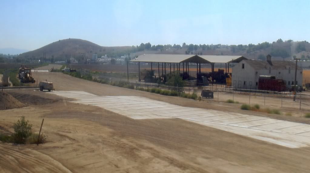
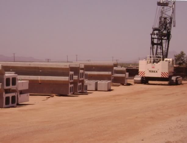
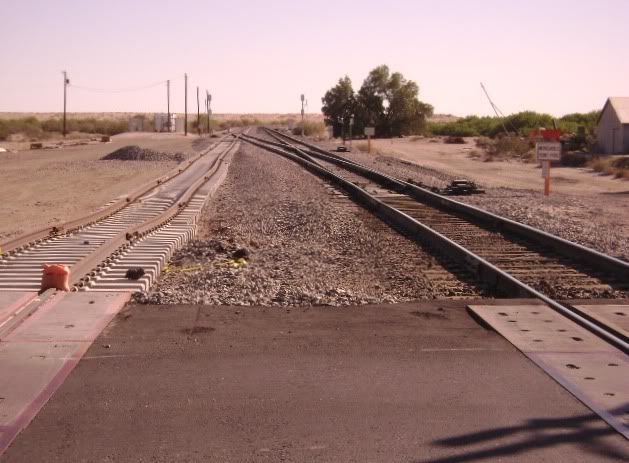
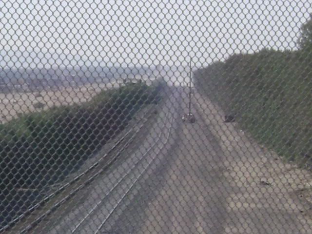
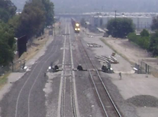
It looks like the Maricopa, AZ Amtrak depot will be moving from the present site. I wonder what this means for the track configuration. Also, I hope someone takes steps to preserve the CB&Q observation car next door, as well. It is being vandalized and rusting badly in places.

The Casa Grande depot will end up belonging to the City. I believe they have plans to make it a museum.

John Timm

Railway Age, May 8, 2008:

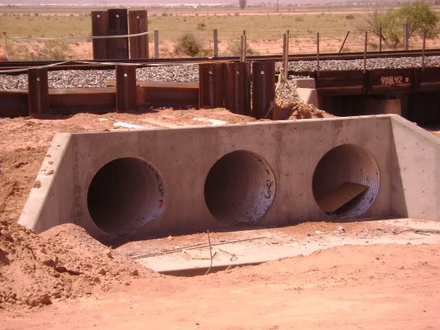
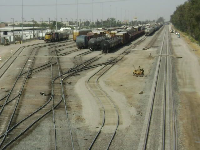
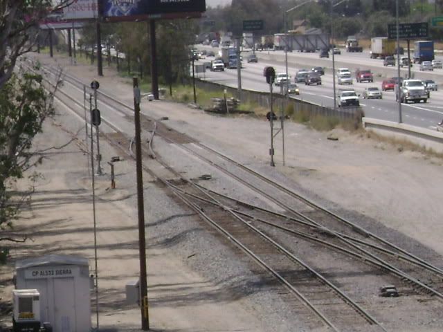
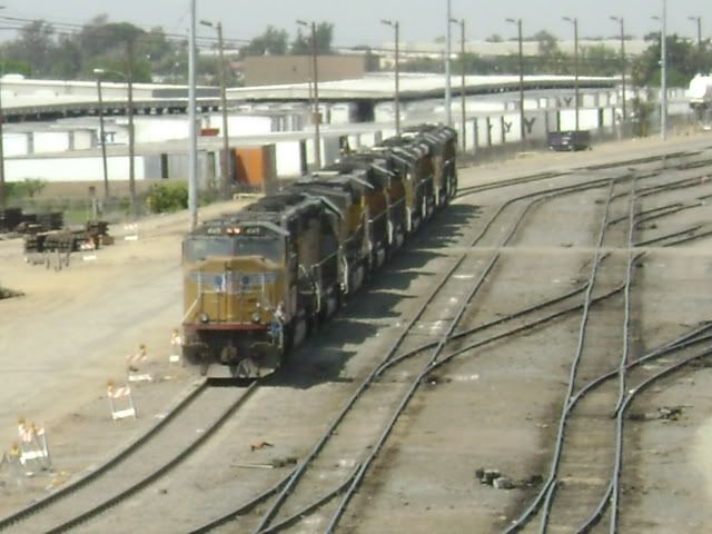
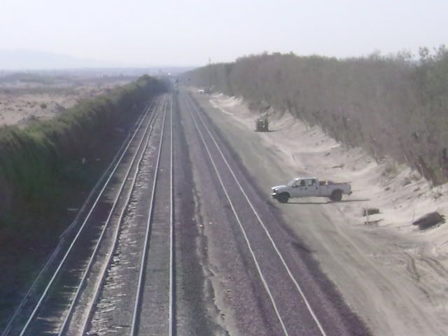
"Union Pacific, trying to clear the way for double-tracking its main line across southern Arizona, has agreed to provide $35 million over the next 25 years to help build grade-separated road and rail crossings in growing Pinal County, local newspapers report.

The agreement, according to the railroad, county officials and mayors of Eloy, Maricopa and Casa Grande, will have Union Pacific pay major shares of the costs of designing of three or possibly four underpasses or overpasses. That represents a change of approach for UP, which previously tried to dampen suggestions that it pay for building grade-separated crossings. A UP official said in 2007 that underpasses and overpasses can cost $10 million to $30 million apiece.

‘It’s a progression. We were able to sit down’ with the local officials to discuss their concerns, said Luis Heredia, a UP community affairs director.

The agreement calls for the local governments involved to identify which crossings will get bridges or underpasses and to support UP’s double-tracking when the Arizona Corporation Commission considers UP’s applications for changes to existing grade-crossings.

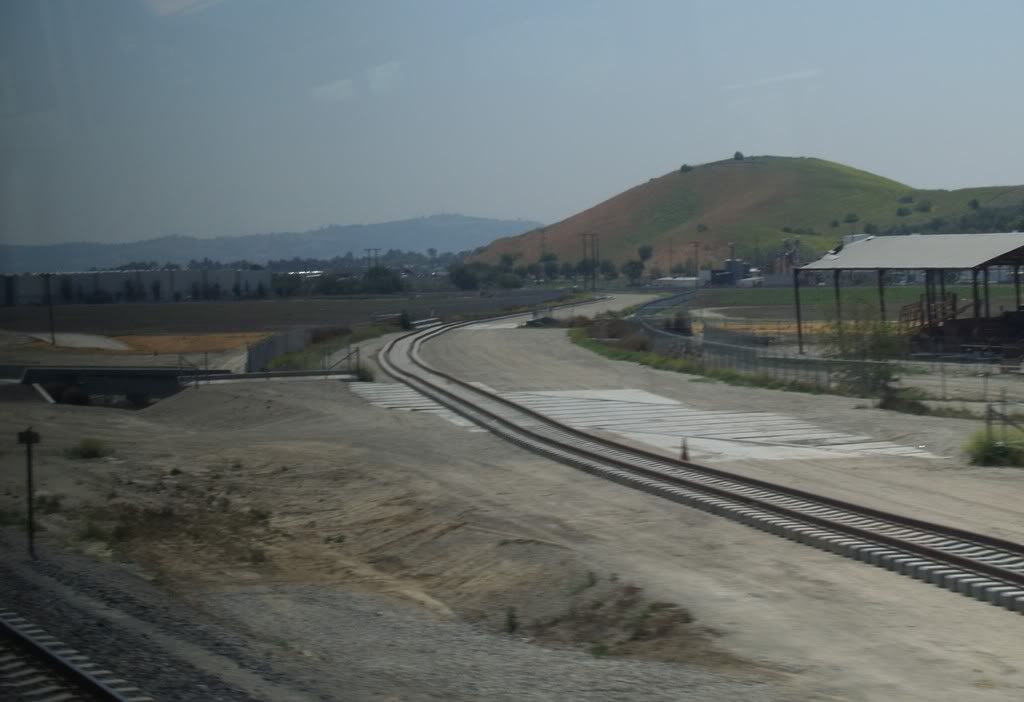
Pinal County is located in south-central Arizona between Phoenix and Tucson. The county has seen extensive population growth as well as increased traffic on local roadways in recent years, raising concerns about the railroad’s track expansion project.

The agreement also calls for UP to take other steps, includi

Pomona**, CA**

Compare MP57313’s May 3 Pomona, CA area SOUTH SIDE photo view looking NORTHWEST from a Metrolink commuter train …

… With the below NORTH SIDE photo that looks SOUTHEAST from Valley Blvd. The ex-Southern Pacific line in the middle foreground is the track that will be eliminated. The reverse S-curve is the new relocated line. Union Pacific’s old Los Angeles & Salt Lake line is in the top background, and is the line MP57313 took his photo from. The new track and right-of-way is now fenced on both sides.

There has been some question about the railroad location called “West Pomona.” Union Pacific timetables do NOT list this location, but, according to sources, the ‘LA Area Timetable Map’ DOES show it. But this photo is proof that the control point place does exist. This is part of the Sunset line that will be eliminated. (Click on photo to enlarge)

Sunset Route Two-Tracking Garnet-Indio, CA as of May 18, 2008:

With high telephoto blur, this shot east of the Amtrak depot taken from the Indian Ave. overpass in Palm Springs appears to show the westernmost CTC signals of a new control point (CP). That CP would be the eastern end of the present “South” siding at the timetable location called Garnet.

View is looking west from the Gene Autry Trail overpass. The Salvia siding (far right) WILL remain, while the new second main is on the far left. Present main is center track.

Salvia, looking east. New signals are in background.

From Date Palm Ave., looking west. Hardly a bridge for railfans!

Looking east.

From Ramon Road, looking west.

[IMG]http://i236.photobucket.com/albums/ff1

Considerable roadbed grading and ditching for drainage has taken place between Maricopa and Casa Grande since my last visit. At Maricopa, it appears that a new switch will be cut in just west of the bridge that spans the large wash east of town. I have no idea what purpose it will serve unless that is to be the new depot site.

At the Bon staging area there are several precast bridge sections with the word “Reject” painted in red across the end. Closer to Tucson, several of the metal culverts have been tagged by the local grafitti “artists.” I wonder if they realize that their “art” will soon be buried for perhaps several centuries?

Ames Construction has moved a lot of equipment to a new site just east of the wye switch at Picacho on the north side of the tracks.

Now that the local mayors and the railroad have made peace, it will be interesting to know where they will install the underpasses that UP has commited to help fund. Maricopa could really use one more than Casa Grande, but the main road through town and the local businesses are located in such a way that it will not be easy to follow the current route.

John Timm

Update as of Saturday, May 31, 2008:

Pomona, CA Temple Ave. overpass. Looking westward at old Los Angeles & Salt Lake route. View shows where the rerouted ex-Southern Pacific line will connect in background right. At least three new turnouts have been constructed

In the past, this forum contributor understood that after the above new arrangement was all in place and operational, a couple miles of the original Sunset Route would be abandoned. But, the following photos (from Temple Ave.) of a pending tie replacement program indicate otherwise

Westbound view

Eastbound

Anybody have an explanation for this?