This topic is for those interested in following the progress of the two-tracking of the Sunset Route between Los Angeles, CA and El Paso, TX.
On Monday, March 3, 2008 this forum contributor traversed the Sunset Route in California between Redlands (MP 546) and Niland (MP 668).
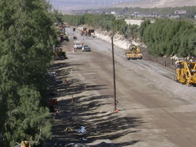
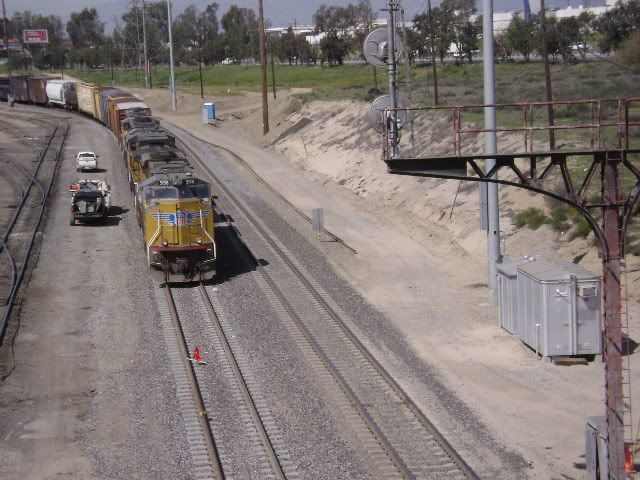
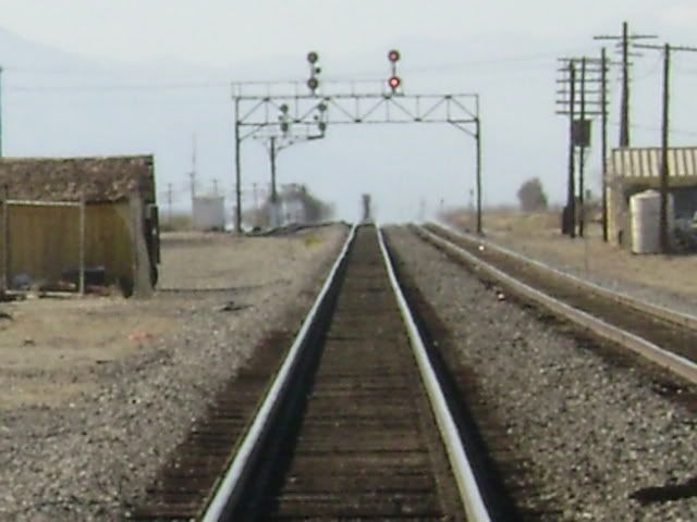
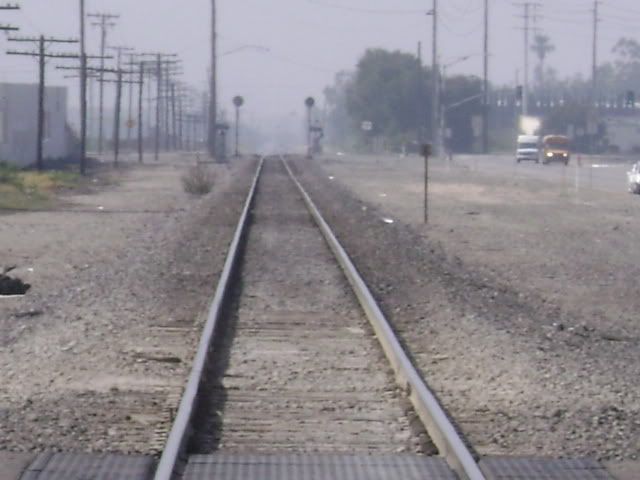
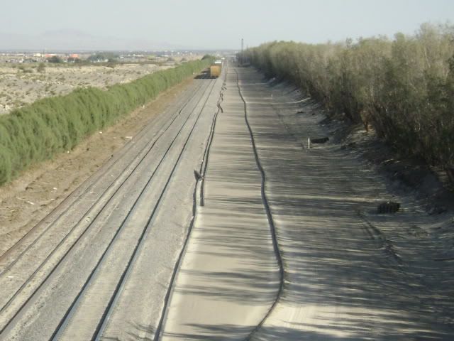
The line was basically devoid of construction activity, except in the vicinity of Thousand Palms. The below photo was taken from the Ramon Road overpass adjacent Interstate 10 and near Rancho Mirage, and looks north-west (westbound).
Of interest is that the future second track will be to the south (left in the photo) of the present track (the signals have been erected), whereas the four miles of existing second track at Thousand Palms (a few miles away to the right) is to the north. That will necessitate and alignment shift
The below photos show (1) where the November 2007 TRAINS cover was shot at, and (2) as the track continues around the curve, how the alignment strangely shifts. The two tracks on the top (of the lowest photo) are original, and the left bottom track is the original single track line. The track on the bottom right was added a few years ago. The now gone Control Point (CP) at that location was called Fingal.
Sorry, I don’t have any photos, but construction right now in Arizona seems to be concentrated in the Willcox area and moving westward. A new second line was recently completed across the Willcox Playa, a dry lake bed, between Willcox and Cochise, but the new grade crossings in downtown Willcox have not been iinstalled.
The City of Willcox, Arizona Department of Transportation, and Union Pacific have been haggling over the crossings in downtown Willcox, with the city and state wanting the railroad to build an overpass or underpass, and that seems to be holding up construction. Main streets of Willcox run parallel to the railroad so close that there’s no room for anything except grade crossings.
Once the UP finishes tracklaying in Willcox, they are expected to concerntrate on the area between Vail and Mescal where one line makes a long loop south, crossing over and under I-10. Their plans are to eliminate this loop by running the east-bound track parallel to the former El Paso & Southwestern line that is their west-bound track.
Once that track is relocated, everything will be double-track as far as Tucson. The UP is proposing to construct a new, 6-mile long automated hump yard in the vicinity of Red Rock, between Tucson and Picacho, to sort out Phoenix-bound traffic. Then they’ll be heading westward toward Gila Bend and Yuma.
A lot of infrastructure work is in progress west of Tucson, in particular from Casa Grande to Maricopa and beyond. There are construction staging areas at Bon and Maricopa. New bridges and culverts are currently being installed on the present main and crews are excavating for bridges and culverts for the second main.
If you look carefully, you can also spot places where signal boxes, poles, radio towers, etc. have been relocated.
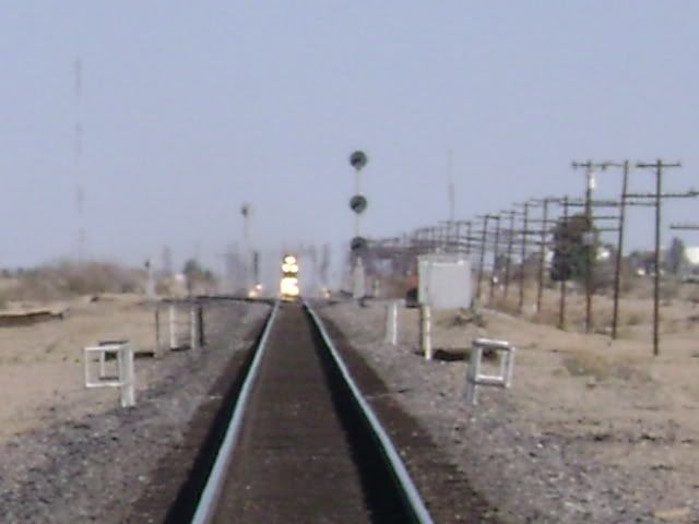
I used to sit under that overpass everyday for lunch when I worked out in Palm Desert. So will there be 2 tracks between Thousand Palms and the west end of DT at Indio?
I got the impression that FROM the new Control Point in the above photo taken west of Thousand Palms TO the doubled track west of Indio was the area of construction concentration. Last Monday a ribbon rail train was laying rail just west of Indio, but I was not certain if that was replacement rail for the present single track or rail for the coming second track.
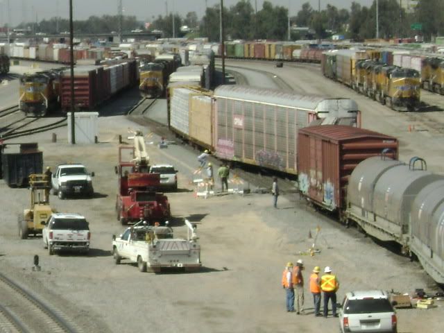
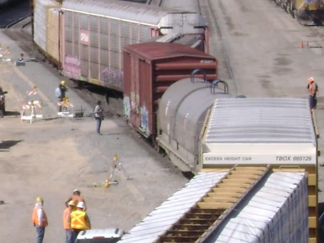
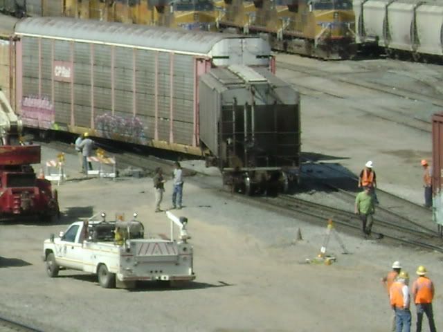
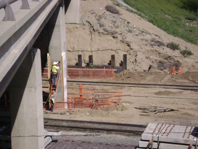
Train wreck time! West Colton Yard incident March 7, 2008, from Pepper Ave. overpass.
West Colton Yard mainline two tracking project, from Pepper Ave., (1) looking west at departure yard, (2) looking at bridge modifications for second main, and (3) looking east at bypass relocation, which apparently will be two-tracked and will be the new main.
Greetings, Jay. That sort of thing has a tendency to happen when you stick those long cars in between those short(er) ones. Espicially if you are pushing a heavy cut and they are on the heavy end.
See, there’s a prototype for everything on my model RR. but I can fix it with my 5 finger switcher. No reports to file. (It may be a little tough to check the wheels with a NMRA gague or file the turnout points.)
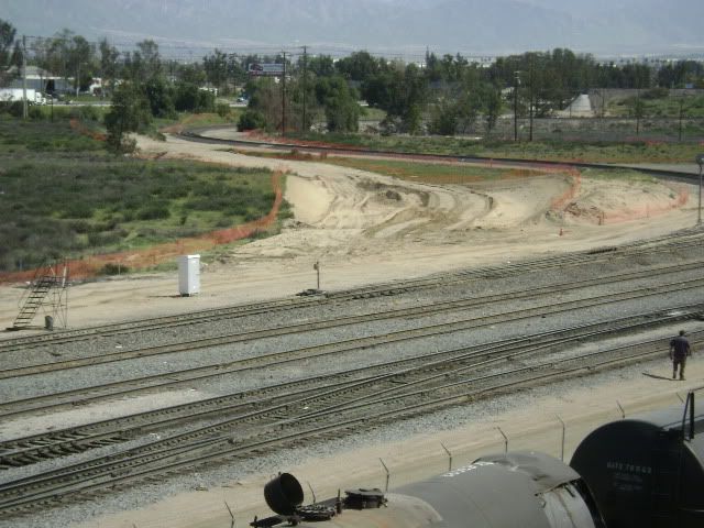
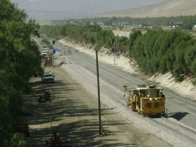
The three photos below show the eastern limits of the 80-mile two-tracking project between Garnet and Niland, CA. during 2008.
The eastern switch of Niland is in the background. The switch in the foreground is the east leg of the wye to Calexico and El Centro.
Taken from the same east end location as above, however, view is looking west to the west leg of the wye.
The view looking east at the west switches Niland. What the exact alignment of the two tracking project will be here is unknown to this poster at this time. The fantastic railfan train pacing Highway 111 is on the far right.
The following four photos were taken on March 20, 2008 from Temple Ave., in Pomona, CA.
The Los Angeles Subdivision, the original Union Pacific ex-Los Angeles and Salt Lake line, and the ex-Southern Pacific Alhambra Subdivision, both between Los Angeles and Pomona, according to the November 2007 TRAINS, page 36 map, are now jointly considered part of the Sunset Route.
The original UP line now appears to be being TRIPLE-TRACKED.
Looking westbound: Center track is the original single-track UP main, and now identified as Track #2; the track to the right was the old Spadra siding, now main Track #1. The under construction track to the left is the new track in question.
View looking eastbound:
The original Southern Pacific main a few blocks away, looking westbound:
Three of the four pictures were taken March 21, 2008 and all in the Palm Spring / Indio, CA area.
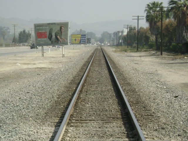
From the Ramon Road overpass, view is looking westbound. The main track is on the right, the new track is on the SOUTH, or left. Progress has been considerable since March 3 when the second photo depicted was taken.
This Ramon Road picture is looking the opposite way, eastbound, and the large sign on the left is gambling related. The present main is on the right side now, the new track is on the NORTH, or left. This will call for a shift in track alignment here.
This shot was taken from the Gene Autry Trail overpass, and looks eastbound. The main is the right track, the left track is the Salvia siding. The new future alignment appears to have already been graded.
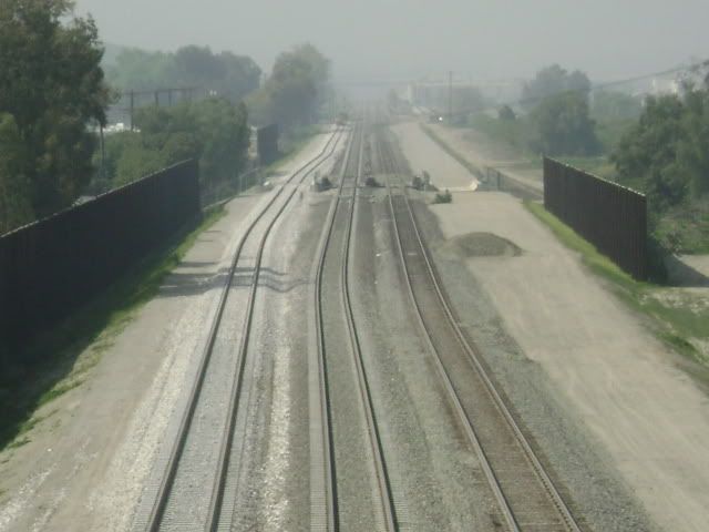
Eastern outer limits of West Colton Yard, view looking west from the Rancho Ave. overpass in Colton, CA. Note how the right-of-way has been expanded. Apparent, the present Sunset main (out of picture on the left, and not to be confused with the switch in the view below) will be rerouted through this area, now called the bypass, and be two-tracked, as evidenced by this shot.
From the same location, view looks east at the crossing with the BNSF Transcon (left is eastbound to Chicago, right is westbound to Los Angeles). Between this camera location and the Mt. Vernon Ave. overpass, barely noticeable in the background, is the section of track that a $148 million, 1.4 mile flyover is planned. (See TRAINS Newswire, February 11, 2008, “Groups object …”
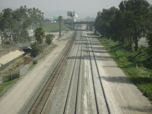
Hard to tell in the distance - are they now working on the realignment of the Sunset route through West Pomona? The new grade has been there for some time, but I have not been out to see if track construction has started.
I drove from Maricopa to Eloy, Arizona yesterday. Ames Construction has just about finished rough grading for the second main between Maricopa and Casa Grande. Bridge and culvert construction is well under way with a couple of bridges compete, except for rail and ties.
East of Casa Grande, they are driving piles and setting rebar for culverts. I did not see any signs of grading yet other than surveyor flags.
There is no control point name “West Pomona” that I know of on either the old UP or ex-SP line (I am using old timetables), so I am uncertain of exactly where you inquired about.
I was out scouting around the Pomona area yesterday, however, and that new third track now appears connected on the EAST end to the old UP main just west of what I believe is CP Roselawn.
No WEST end connection could be located, nor even a third track, in the vicinity of Grand Ave. on the eastern side of City of Industry.
The second main will be on the north side of the existing track along this stretch and at least as far east as Toltec. I drove a couple of miles west of Maricopa and it appears that the main will stay on the north side there, as well. It means there will have to be a transition to connect up to the Maricopa and Casa Grande sidings which are on the south side. This assumes that they will keep the sidings where they are presently and just connect them in which is the usual practice.
It will be interesting to see how they handle those Arizona south-side sidings (Mariposa and Casa Grande) with the north-side second main.
As shown in the bottom photo of a March 22, 2008 post, which photo is here reproduced, the Salvia (CA) siding (around M.P.591) is on the north side (left) of the main, but grading (if it is grading) is on the south side (right). Salvia is the first siding east of Garnet (around M.P. 587). Garnet is where the present two-tracks from the west ends, and the site of the Palm Springs Amtrak stop.
Last year I followed the Sunset Route through Arizona and New Mexico. What struck me was that at a few places on the few hundred miles of completed two-tracking, there was a third track, i.e., a controlled siding including cantilevered CTC signals.
Whether the Maricopa, Casa Grande (AZ), and/or the Salvia (CA) sidings are candidates for such a treatment, is unknown.
Several years ago, in the new two-tracking’s infancy, Cabazon (CA, around M.P. 574) had basically two overlapping sidings, the eastern one on the south side, and the western one on the north side. Part of the north side siding was ripped up, and new track was laid on the south side somewhere between a half of a mile to a mile west, where the alignment shifted on a curve.
Forty or fifty years ago, in San Timoteo Canyon on Beaumont Hill in southern California, around M.P. 557, there were both south side and north s