This is just a little away from your informative post …
I don’t know if you know it or not, but when you copy part or all of someone else’s post, above your composition / editing screen is a link type word, “Quote.” Pressing that button inserts what they said (their post) into your text, and by reason of being boxed, it is easy to distinguish what they said and what you say. But, you have to “Reply” from their post that you want to quote.
About whoever doesn’t want change in Victorville (CA) … I think they are fast becoming outnumbered, and the MAJORITY want through roads to unscramble the massive log jammed, parking lot type throughways.
ccltrains (8-19):
Railroad managements are caught between a rock and a hard place. In the case of UP’s top management, they probably would love to two-track the Sunset Route as quickly as possible, and a few other places too, but pressure from stockholders that have other ideas may tug at them. Striking a happy balance takes skill, and nerves of steel!
SP657E44 (8-19):
You commented: “Metro[link]/UP don’t need their own [additional] mainline when there are three [mainlines] available [already].”
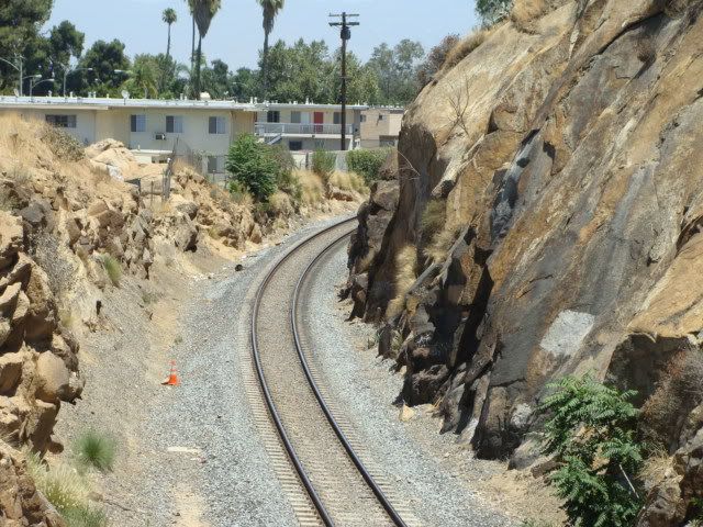
I both agree and disagree agree with that. The three-track track layout has two weak points, one at Highhrove and the other at West Riverside. BNSF’s CP WEST COLTON could be considered a weak point also. A single train can tie up all mains! It is unknown
I agree with your assessment of CP West Colton but until a second bridge over the Santa Ana river is built it will be a bottleneck. A good DS can take care of Highgrove to West Rivercide without delaying either RR.
Waiting to see if you noticed all the things in the vicinity of Prado …
You say UNTIL a second BNSF Bridge is built over the Santa Ana River (in the Colton, CA area) things will be a bottleneck. I think you meant a THIRD bridge, as there are already two bridges there! (Below photo, lower left)
I lived in the Inland Empire in 1976 when the single-track ATSF B-5 Bridge had a second bridge added alongside it, but the appearance of it was incredibly deceptive, giving one the impression there was two-tracks over one two-track bridge. I was fooled for years.
The present Main 1 bridge is a mix of old and new spans, so BNSF may be just band-aiding it until something replaces all of it. The next time I’m out that way I’ll try to get photos of the different spans, but getting those photos might be challenging.
My gut tells me someday BNSF will build a three or four track concrete B-5 Bridge like it did west of Prado Dam.
As a side note, that bridged river west of Prado Dam is the same Santa Ana River that goes under the B-5 Bridge in Colton.
About BNSF’s CP PRADO DAM, some photos were posted in the “Cajon Pass Triple-T
About the new LA&SL bridge over the 91 Freeway in Riverside …
Let me share a tidbit with you … A few months ago a construction worker that was flagging vehicle equipment in and out of the construction area by Panorama Rd. came over to me and volunteered that in a couple of years a second LA&SL bridge would be put in over the 91 Freeway! It was uncertain how truthful and knowledgeable he was, so I didn’t pass it along to the forum. I don’t think UP has a need for a second bridge, but taxpayer funded Metrolink may pay for chipping all the rock away for a second-track just a half a mile away to the west through the Pachappa Cut area.
That might explain why the LA&SL signals have NOT been completely upgraded in the area. Or, it could be just a coincidence. But, again, I am not sure if I should believe the source or not.
[(-D] Thanks for the good laugh, K.P. Seriously, Metrolink is barely able to keep its existing commitments with ever increasing fares, much less expand service on the Riverside line (still none on weekends). In fact, it is cutting service on what has been its most popular (San Bernardino) line.
If anyone works on that cut I hope that the homeowners at the top of the hill are warned. [li]
Overnighting deep in Riverside County, CA on assignment, by 3:00 A.M. K.P. was on the road to Los Angeles, and by 5:30 A.M. everything was completed. He thus afterwards checked out the Sunset Route San Gabriel Trench construction (very near Los Angeles), and found the long shoofly was well along. That mysterious creek on aerials between San Gabriel Blvd. and Walnut Grove Ave. was found to be a deep, concrete lined flood control waterway and NOT just a mere small creek. THAT flood control area will need a radical treatment of some sort to allow a railroad TRENCH to go OVER it! As viewed from the south side, the waterway has what looks like a building going over it (note the top vertical blue stripes), thus blocking a view of where the channel goes under the tracks.
But, the railroad trench construction is now extending A FEW BLOCKS south (towards the camera, above) of the Sunset Route track, involving that waterway! Above, note the construction worker and new dirt, slanted embankment on the lower photo right.
It may take several days to make up a complete San Gabriel Trench report presentation for posting.
Monday …
On the way to Riverside County the day before, the Hunts Lane (M.P. 541.1) overpass construction site (on the north-south borderline between Colton and San Bernardino) was stopped at. There is much left to do, but stunning advances ha
That white and blue building is the former Huy Fong Foods Inc facility where Sriracha was made prior to their move to Azusa and it does indeed extend over the flood control channel. For a chuckle, look at the end of Santa Fe Ave on the north side of the building on Google Earth.
KP well it is now happening in Texas. A short 6 mile segment set to be double tracked just west of Houston.in the Sugar land area. Wonder if this a indication of things to come ? Yes well east of your posts.
The long shoofly has been basically laid from west to east, though still unconnected at each end.
Looking west from Ramona St.:
Above, the shoofly track angles off a bit by the not in service yet mast signal.
The north side crossing gates at Ramona St. are up and operational, but difficult to see for vehicles coming eastward towards the camera and desiring to make a right turn and cross the tracks.
Maybe the grade crossing is obvious when the flashers are on, but this RAILFAN had difficulty noticing them when he made that turn. If a railfan DIDN’T notice them, it is questionable whether a non-rail oriented person would!
Another eastward view: There is NO grading east of that new bridge, so it is unclear if the shoofly will reattach to the mainline in that bridge area, or change sides.
Back at San Gabriel Blvd., where the above photo was shot from, traffic is still extremely heavy, as the four lane roadway is still down to only two-lanes
The shoofly eastward is heavily ballasted, but still needs much more ballast as a kind of landfill for the track.
K.P. leaves San Gabriel Blvd. and heads over to Walnut Grove Ave., but sees something that stops him for an investigation!
From Walnut Grove Ave., that shoofly angles over the new flood control bridge and stops, on what looks like a hot top paved pad for it!
Walnut Grove Ave. is by the present high and wide detector that will be replaced by a similar structure to the east.
Above, as can be seen, NO shoofly track has been laid here, so it is un-discernible what is in store for the future shoofly-wise, or even if there will be one here.
Looking eastbound:
A shoofly in theory could be laid on the right (above photo). Reports indicate the track will be lowered 4 feet through here, at Walnut Grove Ave., so exactly how that will be accomplished is still unclear.
Hi K.P., thank you for the great photo updates spanning SoCal! [:)]
Two points of note (well one question) from me:
1. Amazing progress made on Hunts Lane overpass, although yes there is still lots of work to be done. Hunts Lane has been on the SANBAG website for years now and has been “lapped” by so many grade separations in the area.
2. When all is “said and done” with regards to the UP Los Angeles Sub (old LA&SL) in the City of Industry, do you expect there to be another Metrolink platform added? The best laid plans of “directional running” are hampered by Metrolink having to travel on the current northerly main track just to serve the City of Industry station.
A similar, although more serious, situation currently exists at the Van Nuys Amtrak/Metrolink station, where way more passenger trains have to “fight” for the one long platform.
EDIT: Here is an article saying that the Sunset Avenue grade separation in Banning is “ahead of schedule and on budget”:
Across from the new trusses (left) is the under construction supports and abutments for a third truss bridge plus the relocation of the new ones on the left.
In both the above and below views, across from the left trusses is where the I-215 Freeways passes in a cut. It is difficult to make out at this angle exactly where the abutments will be, but vertical rebar is barely seen in that area.
On this BNSF trackage (that the alternate Sunset Route uses via Riverside and the LA&SL) an eastbound UP approaches. It will take the Mt. Vernon Connector route to the Sunset Route in Colton, change crew, and head to Arizona and New Mexico, and who knows where.
An inordinate amount of Sunset Route trains seem (“seem”) to be traversing the LA&SL these days instead o