Thanks, wanswheel. Great link; beautifully read.
Thanks for the link and thanks for the pictures
@ChessieCat123: Somebody needs to put on record that it’s the whole city that has 8,000,000-odd people (with the emphasis on "odd, in many cases–that’s what makes it interesting). The island with the High Line has less than 2,000,000. Tiesenhausen
Manhattan’s population peaked in 1910, according to the Census.
Manhattan borough - 2,331,542
New York City - 4,766,883
United States - 92,228,496
Which means about 2½ % of all U.S. residents lived in Manhattan then.

Not to hijack this thread but I’m not up on my horse-drawn nomenclature. I think a felloe is something to do with the wheel, but what is a thill or a whippletree? Anyone know?
A thill is either of the two long shafts that are placed alongside the horse and that allow Dobbin to pull the shay. A felloe is that wooden part of the rim of a wheel into which the outer parts of the spokes are inserted. A whippletree is sometimes called an equalizer or leader bar and helps to more evenly distribute the weight of what’s being pulled.
Doesn’t everyone know this? What has happened to education and especially Drivers Education in our schools?
A whippletree is also referred to as a whiffletree.
I imagine you might recall that the New York,New Haven,& Hartford’s Union Freight railroad subsidiary; a shortline that served Boston’s waterfront area, had Climax locomotives that were similarly constructed. The line had boxed body 0-4-0 tank engines before that…
This was a freight railroad connecting North and South Stations with 98% of its track in public streets, mainly Causeway Street and Atlantic Avenue, with numerous sidings. It lasted well beyond WWII. GE made a promotion film on its dieselization. It had several in-street crossing with Boston Elevated - MTA streetcar tracks on Causeway Street.
Don’t forget that most of its run was under the Atlantic Avenue El, before it was torn down. The three-truck climaxes pretty much filled the entire space under the El structure.
NKP guy, thanks for that. Hearing Eddie Albert speak was almost like listening to an old friend.
Actually, 54light15, it was wanswheel who posted that wonderful link which you seemed to enjoy as much as I did. Eddie Albert sure does read in a fine old Midwestern accent that sounds like a friend talking.
These days it sometimes seems that the art of public speaking is dead.
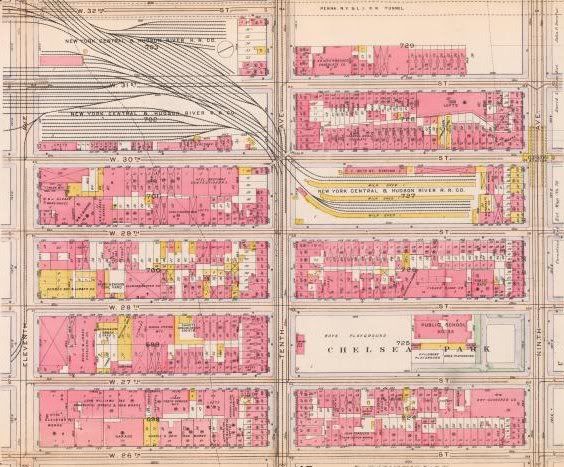
Does anybody have a NYC, CR, or CSX track chart that shows where the crossovers, diamonds, and spurs were ? Friends of The Highline are good people but have very little historical RR info. Thanks.
A10
Lincoln’s train station, where the Morgan Post Office is.
http://dcmny.org/islandora/object/nyhs%3A834
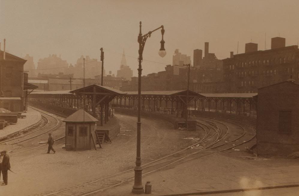
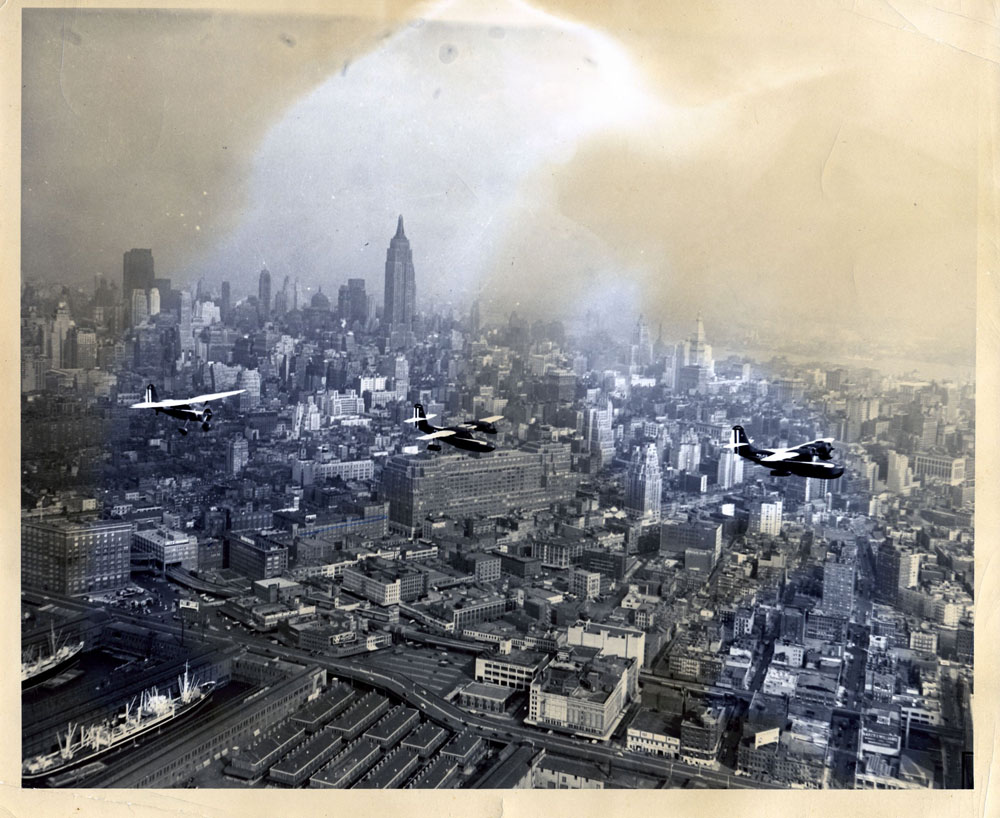
Lincoln’s station as the milk depot with ESB rising. King Kong can hardly wait.
Was there a reason why Penn Station was built so close to the NYC 30th Street yard, or was it just coincedence?
The reason was the location of the LIRR facilities in the Sunnyside and Long Island City area that were to be tied in to the PRR effort. Look at an overall rail map of the area. Land was available for Sunnyside Yard expansion, and this was critical to the success of the project.
I should also point that the reduction in Manhattan’s living populaton was accompanied by a huge increase in working populaton. Also, the living population is at lower density with the elimination of tenement housing. Hunts Point Market, The Bronx, served by CSX, is really the replacement for St. John’s.
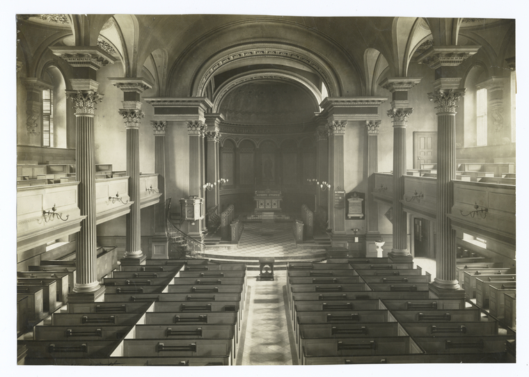
wanswheel: Ever notice the similarity of St. John’s Chapel (where the HR RR had its freight house) and Center Church on the New Haven town green?
St. John’s was a great loss, even if if was for a good cause (speaking, of course, as a railfan!).
Vanderbilt bought the park but not the chapel, which stood until 1918.


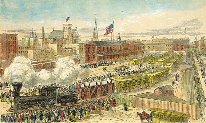
Hudson Street looking north, St. John’s Park on the right, before 1868

Varick Street looking south, St. John’s Chapel down the block on the left
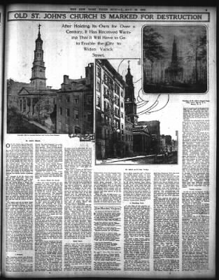
http://query.nytimes.com/mem/archive-free/pdf?res=9504E2D8103BE633A25756C2A9639C946296D6CF
http://www.nytimes.com/2008/04/27/realestate/27scap.html?_r=0
http://nygeschichte.blogspot.com/2013/06/st-johns-on-varick-street.html

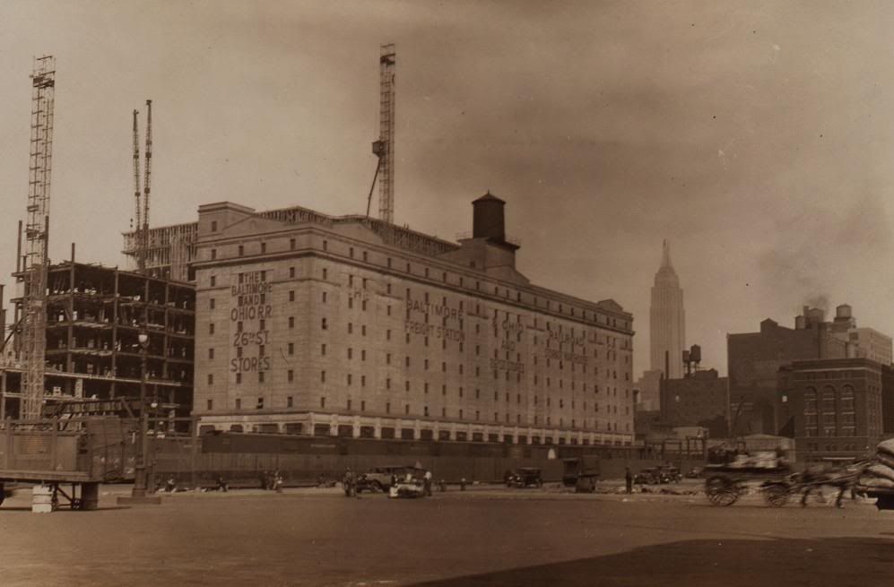
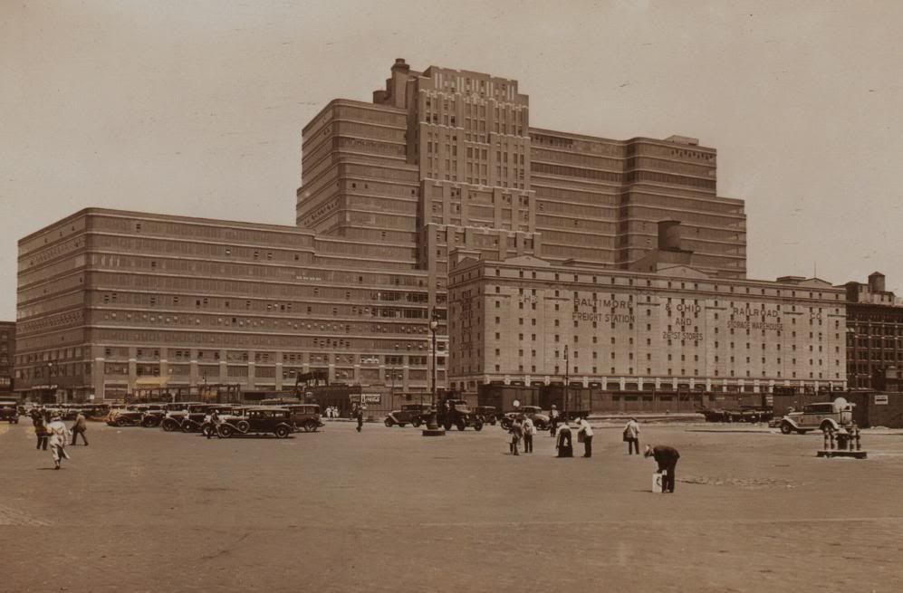
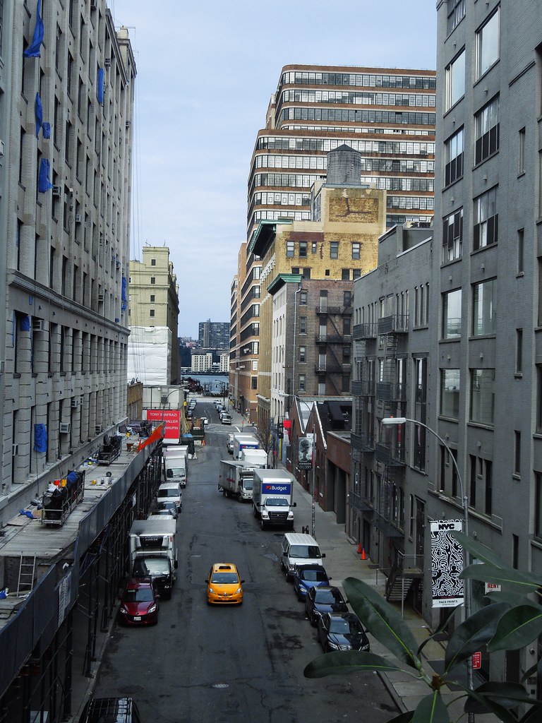
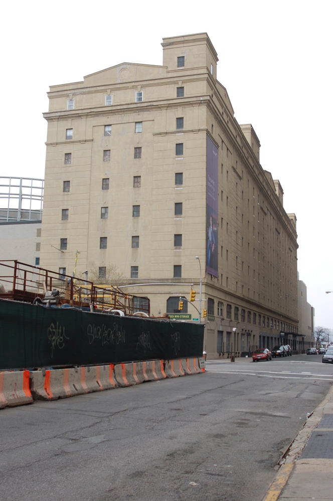
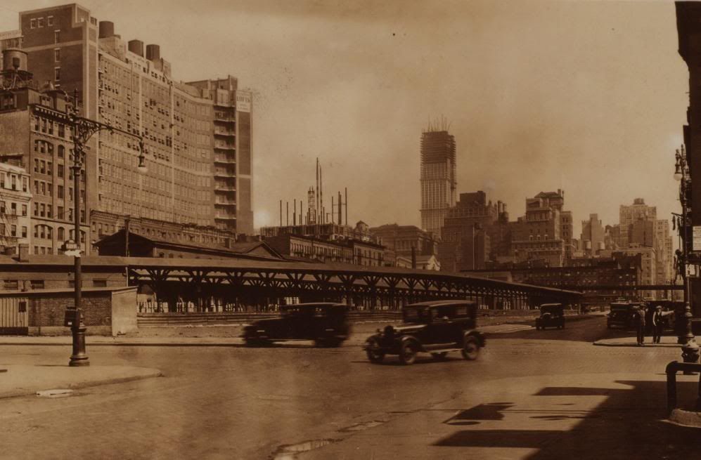
View from the High Line at W. 26th St. The B&O freight station is about a block away on the left, at the southwest corner of 11th Ave., across the street from the Starrett Lehigh Building on the right.