I remember when I was stationed at George AFB way back in 1992 there was talk about the new road crossing the Santa Fe near Frost, elimination of the flyover and crazy talk about a third main being added from Frost over Cajon. The way things were being talked about then, I expected to see the new road in place years ago along with the flyover. The last thing I expected to see happen first was a third main. To find out that neither the new road and the flyover removal have happened 22 years later is a little bit amazing. From my trips through Victorville on I-15 I would have thought that the growth in the area would at least have seen the new road project completed. As far as the old Hivolt siding goes, back in my time at George (1985 - 1992) SP would use the spur as a helper pocket. Helpers used to wait there for trains heading down Cajon so they could add the additional dynamic braking power and trains helped over the pass would often cut off helpers and they would be parked there. I see on Google Maps that these days there’s a new to me short setout track off the Hiland siding and that’s probably the helper pocket these days.
Thanks Vern and BNSF for the comeback.
HIVOLT is what I remember as well. Just not as quick on the draw in the memory banks these days.
The road across Victorville and into Apple Valley was planned and funds acquired to build it. The green minded ones decided to stir up the pot, with their hands out wanting a piece of the pie. They got a judge in the Banning-Beaumont area to freeze the project. Traffic just got worse and worse until one day a green minded one figured out how much of a carbon foot print he was creating sitting in traffic on 7th st. raising his kids to a semblance of maturity and decided it was ok to build the new road. Sadly, it will still be a bit of a quagmire as folks continue to move to the desert. Not a lot of inexpensive housing left in the greater basin of Southern California.
Anyway, we shall see what happens next. Watching all the fun from this hill top vantage point.
Status of the Friday, August 15, 2014 Update
The basic composition and organization outline is more or less done, and next the photos will be worked on and transferred to Photobucket for showing here at the forum. Some of the concepts and photos to be presented may surprise some here at the forum. Tentatively, as of now, two groups are planned, Parts A-H and I-Q.
Tentatively, Part P will have this photo of the Vineyard Ave. underpass construction in Ontario (CA) …
… which construction rises the Sunset Route (behind the camera) by 4 feet.
Wouldn’t You Know It?
There has been much Sunset Route thread replying of late related to BNSF’s “natural crossover” in the Frost (Victorville), CA area. Unbelievably, K.P. was ‘out of the blue’ dispatched to Victorville yesterday afternoon, Sunday, August 17, 2014. And, he was able to check out that natural crossover area firsthand, and will share some of the findings in the replies below.
Replies
BNSF6400 (8-16/17):
Your sharing the bridging news in the Frost, CA area got me rather excited, and when a surprise dispatch came for Victorville, I hopped on it with gusto! Somehow I had envisioned bridging over the BNSF tracks now in place, but I only found some new auto roadway grading , orange pylons at the blocked Ridge
To All Interested in BNSF’s Natural Crossover (Continued)
From up above and east of the natural crossover, it can be seen that trainmen have a pathway to walk their train if necessary.
Even the M.P. 39.1 Bridge has walkways.
So, with these things in mind, doing away with the natural crossover for safety reasons seems kind of unlikely.
Below right, the BNSF tracks are seen, with Green Tree Blvd. up towards the photo top.
That Green Tree Blvd will somehow have to come towards the camera, go over the tracks, and swing to the right to connect with Yates Rd way behind the camera’s right.
LA&SL trains have trackage rights on this BNSF subdivision. It seems most of those trains transition to or from the Sunset Route, utilizing the SP track to or from Pomona.
More Replies
SP657E44 (8-16):
<
Hi KP,
Quoting you:
BarstowRick (8-17):
Vigilance is good, but paranoia leads to un-Americanism!
Railfan & Railroad Magazine proved that! Some commuter outfit tried to take the photo rights away from those associated with that magazine, and by the commuter outfit trying to do so, it encountered those determined to uphold America’s great freedom and the liberty the nation’s flag stands for! And, those freedom fighters won in the courts! End quote.
My response. No disagreement here.
What I was referring to is more historical, pointing to the every day operations on most spur lines or spurs back when HIVOLT was built. Did I emphasize “Spur” enough…sigh!.
Paranoia implying that all the new gizmo’s and gadgets Ie., the electric switches and signals installed…today…is due to paranoia. Safety being the ultimate concern, of course. At one time unlocking the lock and opening the switch manually was considered to be every day practice by railroad crews as the locals moved about switching cars Ie., picking up empties and delivering full loads.Track warrants ruled the day and a dispatcher would simply move the trains as needed keeping in mind the location of the next through train. Got’s to keep the mainline clear. Anyway, no big deal. Just pointing out how much things have changed as you have noted here since 9-11
The short siding as illustrated by the aerial link. That’s been there ever since the Palmdale Cut Off was built and t
We keep hearing about capacity problems all over America. The railroads are adding capacity as fast as they can but it does not happen over night. Case in point is the Sunset route. Over 5,000 blogs ago KP started a great line in covering this upgrade and it still is not completed but getting close. Buying more locomotives and getting more crews will help a little with congestion but what is needed is more track to handle the congestion. This problem is not just with the Sunset route. Just be glad we do not have to live with Chicago and its congestion.
How many tracks come north out of Riverside ? Three.
BNSF’s latest projects on the SB sub ? Three tracks at most locations (Valley View has 4 because of the yard lead on the south side). Metro/UP don’t need their own mainline when there are three available.
A10
Each case is its own animal. BNSF is conducting a (questionable IMO) strategy on their Northern Transcon to give oil priority over ag products - Bad Will hangs around for a Long time. BNSF has bought many locos recently but the track capacity has not kept place.
OTOH I’ve noticed that UP insiders complain about investments in shiny new DT but way too many inadequately maintained engines that can’t pull to keep up the flow of traffic. Go figure.
Don’t think we’ll see much push for triple tracking - two mains and maybe a few staging sidings will go a very long way vs single track. The 3MT ‘gap’ in the BNSF San Bernardino sub north of Highgrove is very short in the big picture. Likewise they are letting the publicly funded grade seps in LA and Orange County set the pace, obviously no big rush.
UP isn’t pushing much harder on the Sunset Route - 30 to 50 (?) new miles of second main a year. If they were really hurting you would see a contractor led ROW grading blitz in CA and AZ. Show me the contracts!
Just a suggestion, but discussion of further BNSF expansion could be moved to these topics:
I think UP’s approach makes sense when you take it up a level from just the Sunset Route.
Let’s say they did a blitz and finished the double tracking by the end of 2015. The goal I’ve heard is to be up to 70 trains a day thru TUS, but the harsher reality is that UP doesn’t have the yard space or the crews & equipment to handle that type of volume. The eastbound yard in Red Rock is still 24-48 months away from being operational. It wouldn’t surprise me to see it going into operation about the same time they finish the double tracking.
BarstowRick (8-19):
How about You and I Go to Mars?
Do you want to know a secret? I have a spaceship! Would you want to go to Mars with me? (Just kidding …)
Seriously, about a block south (left) of Coad Rd. (that photo bottom road that aligns with the photo top Green Tree Blvd.) in that photo I posted, duplicated here …
… is something almost Mars-like. It kind of looks like a curving road, but has no beginning and no end, and doesn’t have any connections to the present roadways. …
The spaceship actually was landed on it.
I have no idea if someone was going through their second childhood and played grader or something, or the City was acting like UP in two-tracking the Sunset Route, i.e., only doing short segments at a time of a future road. But, I just thought I would pass that along … to put a little Mars fun in your life!
KP LOL
I will requisition the space suits and all the necessary junk food and we can start planning our trip. Funny!
Shoot, no don’t do that. We don’t need another international incident. All the hype and news about the mars land rover. Pasadena could film documentaries of what’s going on on mars via the desert scape around Victorville. True.
Incidentally the road you referred to as having no beginning and no end is where I taught my daughter how to drive. It is a circuitous road which was perfect for learning to slow, brake and steer. It connects with the Hesperia road just west of the last visible curve. I’ve had heart trouble ever since. COL
From what I can tell as per BNSF’s submission earlier, the plans for four lane road have changed dramatically. Do I dare say not a good traffic plan. Time to duck and run.
K.P.:
All this discussion about a new road and bridge to Apple Valley has been very interesting. So much so that I e-mailed a friend in Victorville who previously had a detailed blog about the Ranchero Road underpass construction, hoping to get some insights from him.
He reports that construction on new bridge over the Mojave River has started, and that, even today, work had been done on driving pillings for the bridge’s foundation. He says that the west end of the bridge is very near to his Spring Valley Lake development.
My friend is familiar with this thread and may be able to provide photos to the forum, if anyone is interested.
John
Found this link with some “live” cameras on the project.
http://trafficcctv.com/YuccaLoma.html
Other cameras…
Thanks for the links to the camera views and yes any pictures welcomed.
Look out KP, you might be in for some competition. Mars, still chuckling out loud.[:D]
Update as of Friday, August 15, 2014
A Wide Review from Ontario …
… to the City of Industry, CA
Part “A” (of A-H, Overall A-Q)
The Harmony Theory
The Diversion
Pomona Area
This group (Parts A-H) will review some odd things related to the Pomona Diversion, and make the forum aware of what is physically in the area, things that may give us some insight about the future.
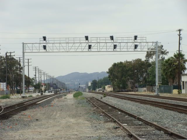
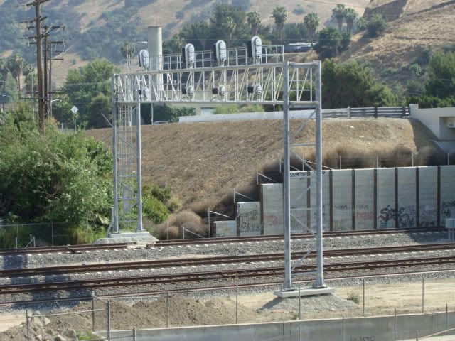
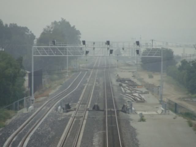
Concerning the “Diversion” the NOW not-in-service-yet signal bridges after many, many months of being erected in Pomona …
Above, looking west from downtown Pomona (June 8, 2009)
Above, the east side westbound signals by Humane Way (the west side has a signal bridge too for eastbound movements) (May 13, 2009)
Update as of Friday, August 15, 2014
A Wide Review from Ontario …
… to the City of Industry, CA
Part “B” (of A-H, Overall A-Q)
The Harmony Theory
The Diversion
Pomona Area
Currently, one track in Pomona, through swing-changing of alignments (lower right to center) …
Westward, October 17, 2009 photo
… is the STRAIGHT THROUGH track, so that trains on the Alhambra Sub (SP) Main 1 (lower right) in the EAST (behind the camera) transition automatically to the Los Angeles Sub (LA&SL) Main 1 on the WEST, and vice versa.
Currently too, because of the MOVEABLE POINT FROG SWITCH at CP C031 OAK, ALL trains utilize a seamless route in that transitioning between subdivisions, IF from Main 1 to Main 1 (above photo), or Main 2 to Main 2 (foreground lower left track of above photo) between those subdivisions.
Just as a refresher for those unfamiliar with moveable point frogs, a December 12, 2011 photo is reshown, the switch happens to be at Sunset Route CP SP598 RIMLON in the Lower Desert of Southern California, in the Thousand Palms area.
Update as of Friday, August 15, 2014
A Wide Review from Ontario …
… to the City of Industry, CA
Part “C” (of A-H, Overall A-Q)
The Harmony Theory
The Diversion
Pomona Area
The “A” Track (far left) looking west from Temple Ave.:
In the above June 15, 2014 photo, the far left “A” Track ends with just a Maintenance-of-Way switch for the connection
K.P. is inclined to believe that THAT TRACK is an accounting trick, as a railroad contribution to the Diversion, and won’t be used, at least at first.
The “D” Track, the FUTURE northernmost (rightmost) track, which presently is not laid, will go through the CP west of Temple. Ave. and curve to the Alhambra Sub’s original alignment
Update as of Friday, August 15, 2014
A Wide Review from Ontario …
… to the City of Industry, CA
Part “D” (of A-H, Overall A-Q)
The Harmony Theory
The Diversion
Pomona Area
SOMETIME IN THE FUTURE, Main A (that currently ends WEST of Temple Ave., at the western END of the Diversion) likely will be laid west, on the SOUTH (left) side, past Grand Avenue …
… so that there would be THREE tracks.
In the above December 11, 2009 photo with an eastbound UP crossing over, it is unknown if that CP C026 GRAND (M.P. 26.2) will survive. Probably at first, but its long term future is questionable.
Interestingly, the installed switches at the CP west of Temple Ave. seem to be at the west end of the CP, allowing a counterpart pair of crossovers to be
Update as of Friday, August 15, 2014
A Wide Review from Ontario …
… to the City of Industry, CA
Part “E” (of A-H, Overall A-Q)
The Harmony Theory
The Diversion
Pomona Area
In the last photo in Part D, a curving to the right is seen. Around that curve is a Metrolink commuter stop!
That above train is westbound, moving away from the camera.
An eastbound view and some of the stop’s covered seating.
Above, look at all the beautiful parking lot trees on the photo left.
But, the beautiful commuter stop’s platform may be on borrowed time! Why?
We have to go DOWN to get more perception! Sidewalk ramps have the fun look that might appeal to children!
Update as of Friday, August 15, 2014
A Wide Review from Ontario …
… to the City of Industry, CA
Part “F” (of A-H, Overall A-Q)
The Harmony Theory
The Diversion
Pomona Area
Another look, southward though.
Did you notice at the above photo’s top bridge center support pillars that they include supports for a third track?
A focused look:
Did you notice towards the right the greenery escapes covering a concrete area, an area that would hold up a bridge section for a third track?
The east indented concrete-work for a third track bridging.
From underneath:


