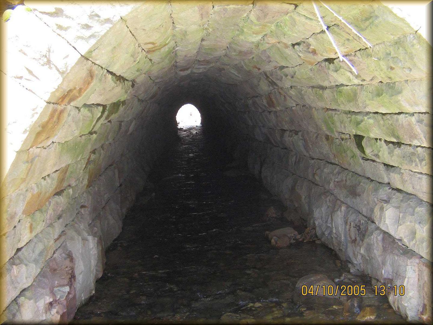
Here is the inside of the great South Penn culvert. It is not a railroad tunnel as a lot of people think. This is located in the Bucannon State Forest along the Pike to Bike Trail.
Here is the inside of the great South Penn culvert. It is not a railroad tunnel as a lot of people think. This is located in the Bucannon State Forest along the Pike to Bike Trail.
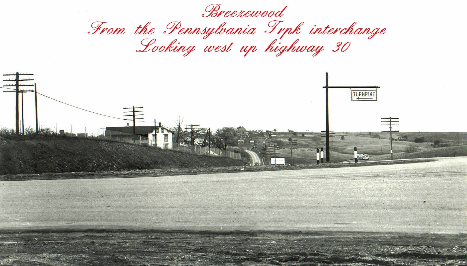
This is Breezewood just about the time the turnpike just opened.
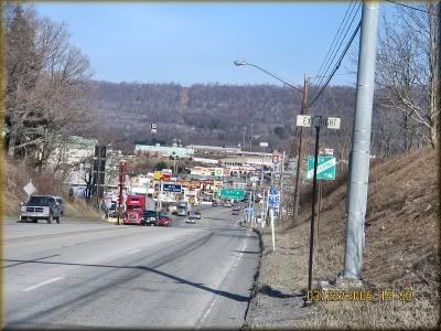
The same town but looking east from the opposite side of the route 30 corrider looking through Breezewood.
…Amazing, the stone work on those culverts. For this long one for example…I wonder if they first built a wood form to put the stone up on and then lock it with the keystone, etc…Also I wonder how they lifted such heavy stones in place…Remember this is all being done out in the wilderness…Not in civilized and metropolitian areas for the most part where machinery {if available}, could be put in place to do the lifting.
Tunnels of almost all kinds…railroad or vehicle type are worked from both ends…Some where possible are opened at four locations making 6 headings available to work hence advancing the boring much quicker.
The massive railroad tunnel over in the Alps mountain region that was described in a TRAINS mag. article back some months ago is being worked from many headings…Since it will be something like 35 miles in total length it would be necessary to be boring on as many headings as possible to inhance the progress.
Remember the Chunnel across the English Channel was bored from both ends and it was not just a straight line of boring and they met somewhere out near the center within a foot or two of being in total alinement. {After something like 25 or 30 some miles…!}.
Pennsylvania Turnpike tunnels were bored from both ends too.
For sure it takes accurate surveying…and I for one, never have understood how that is done to the accuracy point of being right on for a meet in the middle.
Coal mining gets into such type of surveying at times too…Especially when a rescue effort is put forth perhaps a mile or several miles from the mine entrance…they survey back to a point to where they know miners are trapped and put down a rescure shaft and of course they must be right on…Example: Recent operation near Somerset, Pa. mine rescue of the 9 men trapped from a break through into an old mine releasing millions of gallons of water trapping the men. The bored shaft was the route they were rescuded out of the m
…And Russ, one little tidbit I read some time ago about Breezewood…{which is about 50 miles from my home}…In some time frame in the past, Breezewood had 35 residents and at night the population…{during the vacation driving season}, ratcheted up to over several thousand at night…Even the water table dropped an amazing amount at night…Don’t remember the figure.
I am amazed as well. The tunnels on the turnpike started by the railroad was done by a tree cut atop the mountains. I have even seen the stone monumnets as the railroad called them still atop the Allegheny as well as recently atop the Blue Mtn. Tunnel. Almost identical. That is one way we are able to spot which tunnel is the actual railroad tunnel as the trees are cut above the top of the mountain to each side cut by the railroad. The turnpike built the new tunnels by simply measuring to the left or right depending where they were going to build the new tunnel. The turnpike still has the survey tools (line of sight , all be it hanging on the ceilings in Highspire) used to keep the center of the work done inside the turnpike completion tunnels.
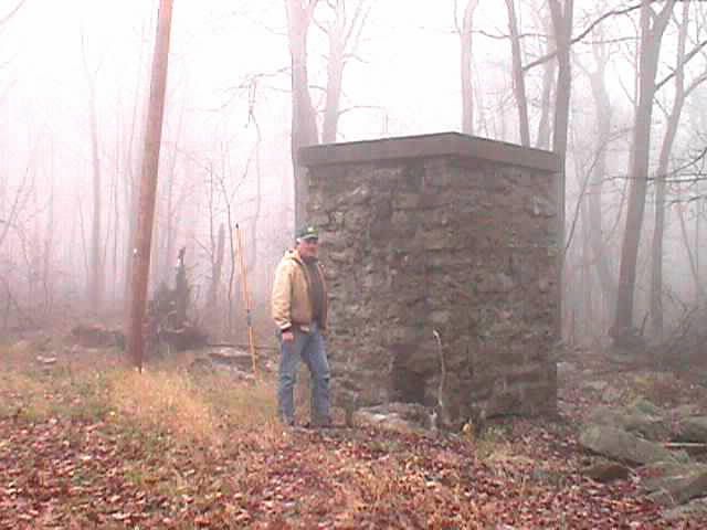
This is what the railroad called a monument. A letter I have is from the work done on the Allegheny Mountain and explains that soon a survey monument wold be built.
I can see that happening. That town is a phenomona. But I never eat in that town anymore. I eat in Bedford at Ed’S Steak House or the Pizza shop atthe intersection of 56 & 31.
…“hanging on the ceilings in Highspire”…Not sure that meaning…??
Like ceiling fans!
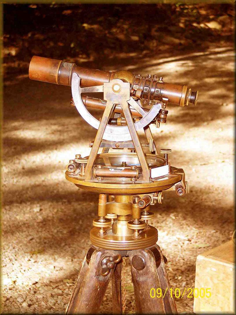
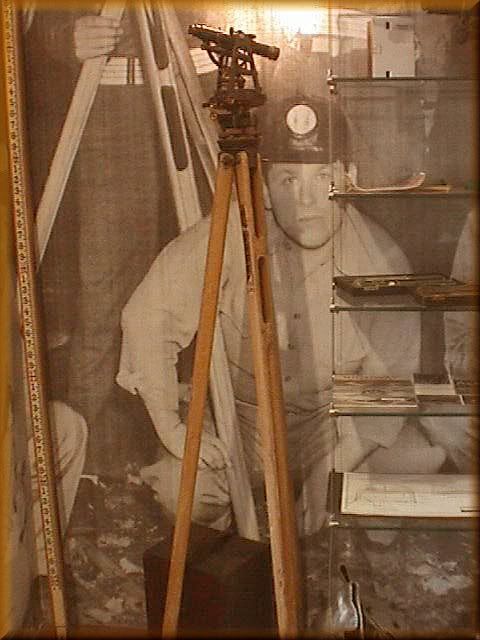
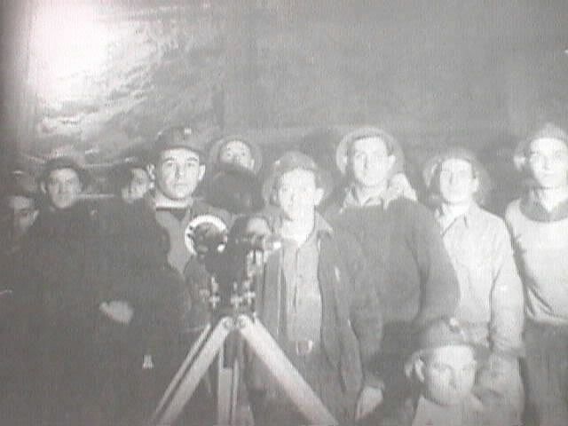
An expert on surveying in Somerset County, says this is the most likely item used in surveying the South Penn along the whole route.
Had the South Penn been completed, would most likely look like this as colore routes planned and explored by me. The blue dots are the tunnels along the Pennsylvania Turnpike. This also includes the Harrisburg & South Western to Hagerstownand the Western Marlyland connection, the EBT connection, the Latrobe aligment, the Youghioghey alignment and Wheeling alignment.
Want a larger view? E-mail Me for it.
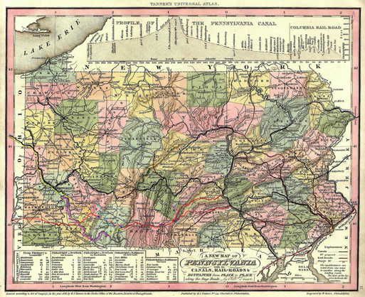
…I have a tourist size map of Pennsylvania…roughly 24 by 30" produced in 1928 and it’s in real good condition. Sadly it does not include railroads marked on it. But it is interesting to look over.
Item: Train derailment in Muncie here today…Don’t really know much of details yet. I have a post of it on the forum here anyone interested.
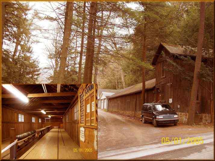
Not all my research is the South Penn, But while looking for a South Penn landmark, I stumbled upon this old Bowling Alley at Sulpher Springs, south of Manns Choice, Pa. It appears the South Penn was considering this just might be a side line for passegers riding on the rejected Bedford Spring survey aligment to be able to utilize this springs resort. It is well smaller then Bedford Springs.
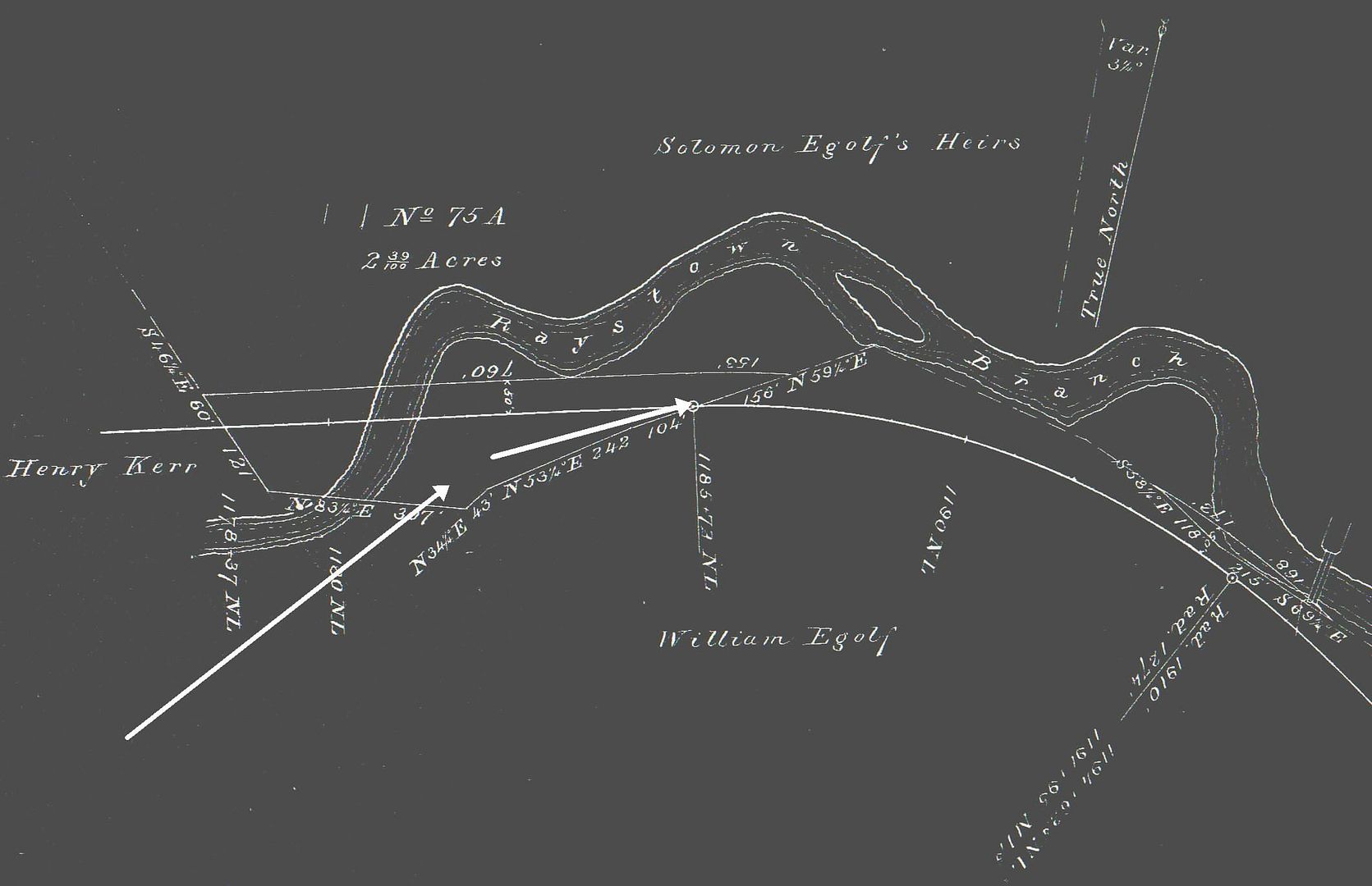
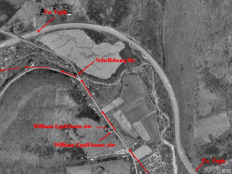
The two photos show the same area located just west of Manns Choice in Bedford, County. Compare them for yourself as to where the never built railroad was to be built compared to where the turnpike was built. The top map was drawn by the South Penn surveyors of 1881-1884.
Can you spot the South Penn railroad on this aerial photo at Fort Littleton, Pa? It’s really easy… Try looking for it.
Well you have several interesting one’s Russ…and yes, I can spot the alignment on the Ft. Littleton pic…The designers really did provide nice gentle curves on the S P ROW. Just for some who did not see it…enters upper right comes down at a slight angle and curves over to the left {of the pic}, and down to join the Turnpike alignment.
Like the bowling alley…I must have been very close to that in my travels around the Manns Choice area years ago.
And again, there west of Manns Choice the S P RR would have come along that bank on the left side of the valley as one proceeds west on 31…Cabins are located in that area now and of course have been for years…I ran this route during test work years ago for thousands of miles…up that nice green and beautiful valley…Than tackle White Horse.
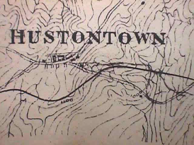
Use these two tools to see where the South Penn was to be or was built south of Hustontown, Pa., just east of te Sideling Hill Mountain and west of Fort Littleton, Pa.
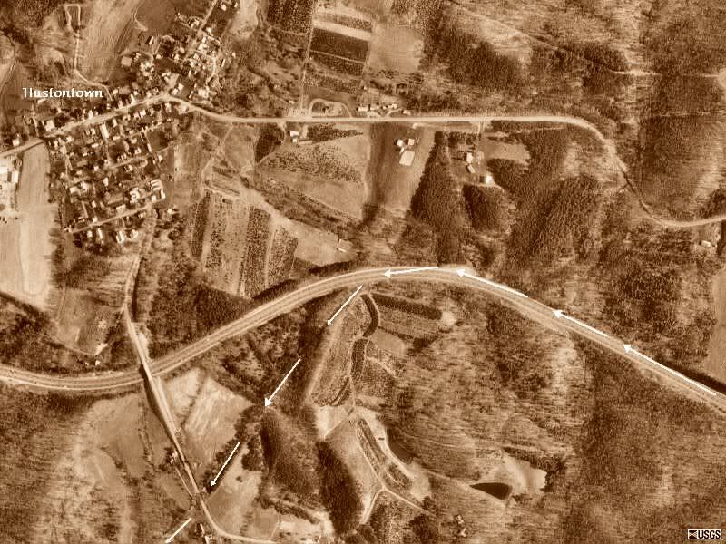
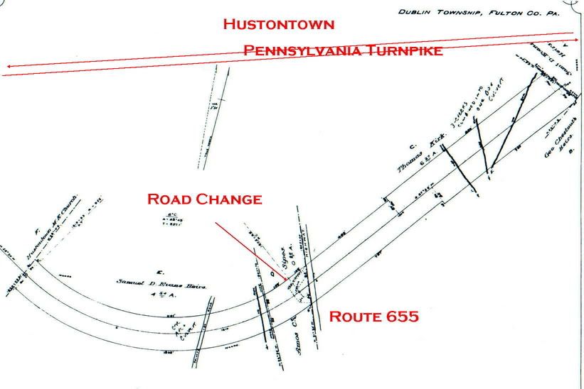
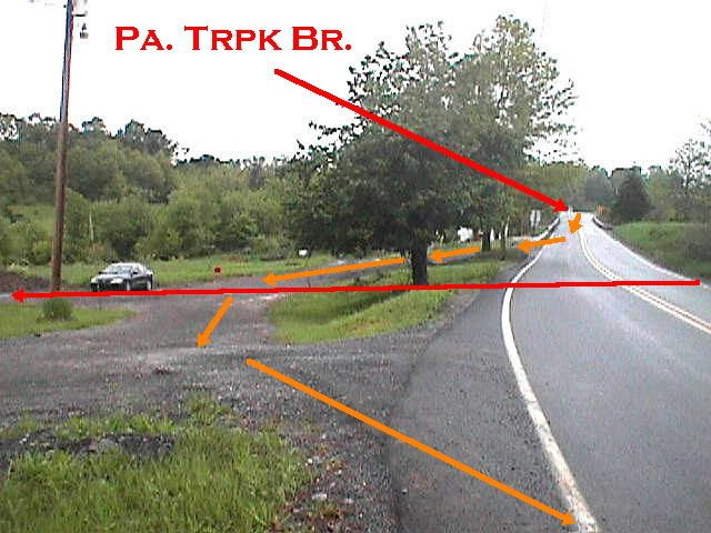
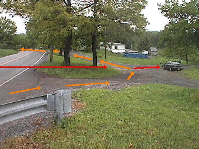
Of course the South Penn was going to have to cross dirt roads that are today highways. Sometimes roads were just a little higher then the tracks crossing them. The railroad had to provide a way for thin wagon wheels to not get stuck in their tracks. This site shows how the Sourh Penn was to have to cut down this little hill to get across this route known today as highway 655 south of the community of Hustontown. They show clearly how the road change was to be made west of the original right of way. The railroad came close to this road but was never completed. The road change was completed as seen by the photos but the railroad never was competed across this road. The orange arrows represent the road change for wagons.
The red arrow represents tyhe east to west railroad alignment across this highway. In the color photos, I am parked directly on the built railroad grade alignment. Notice how I am sitting parked a little lower then the grassy island. The island needed to be removed yet. Never will!
By the way this site is located in Fulton County, Pa.
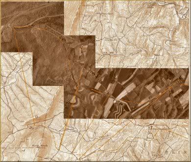
Racing from the south is this set of maps and aerial photos showing the railroad still in the countryside south of what is known today as the Sideling Hill service plaza along the Pennsylvania Turnpike. This is one of the best sites to spot the railroad grade.
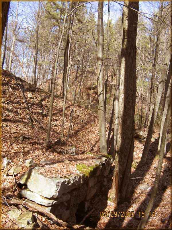
This section of unfinished South Penn fill is located on state game lands just east of Breezewood. A perfect site to explore workings of the railroad started 120 years ago. It shows the unfinished crossing fill with a box culvert. Because the South Penn was never completed I had to choose a topic in which to focus on. This work never completed became my goal to seek and discover all unfinished work sites and document that subject.