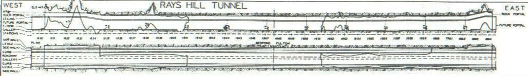
The Pennsylvania Turnpike in 1938 did a comparison chart showing the completed turnpike tunnel and showing the unfinished section within their tube. This is the Rays Hilll Tunnel. They did this on all the tunnels they were going to use.
The Pennsylvania Turnpike in 1938 did a comparison chart showing the completed turnpike tunnel and showing the unfinished section within their tube. This is the Rays Hilll Tunnel. They did this on all the tunnels they were going to use.
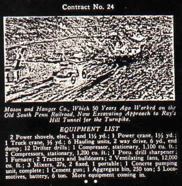
Is it possible that a company that worked on the railroad to get a contract for the turnpike as well? Well this company that worked on the Rays Hill tunnel in 1938-40 did indeed work or have a coontract for the railroad and got a contract for the turpike fifty years later. As a matter of fact this company still exist to this day and is located in Tennessee.
…My comment would be: That speaks well of a company to have longevity…Something too rare anymore.
That one piece of information would make me feel proud. I will locate where they originally worked on as a railroad contract.
They originally had the contract to do the west blue mtn. tunnel as seen by the letter head on this document.
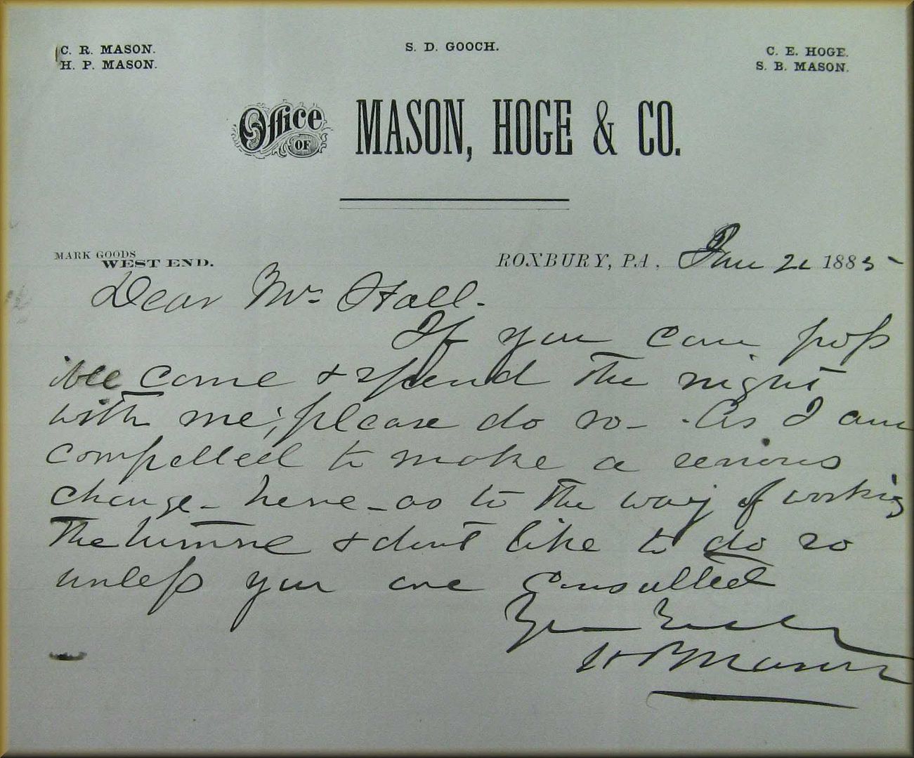
…Fabulous document.
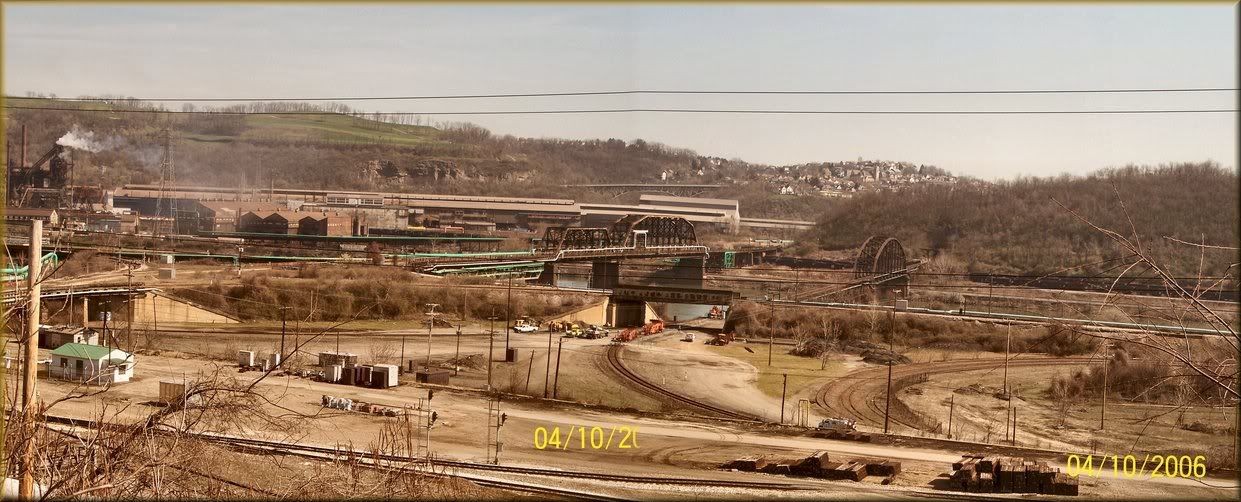
This site at PORT PERRY across the Monongahela River would have been the South Penn’s semi final destination as this is the well known Edgar Thompson steel plant. Carnegie wanted this site for the South Penn to pick up his steel products to be shipped east instead of on the Pennsylvania Railroad. The union railroad yards I think? once belonging to him is in the foreground.
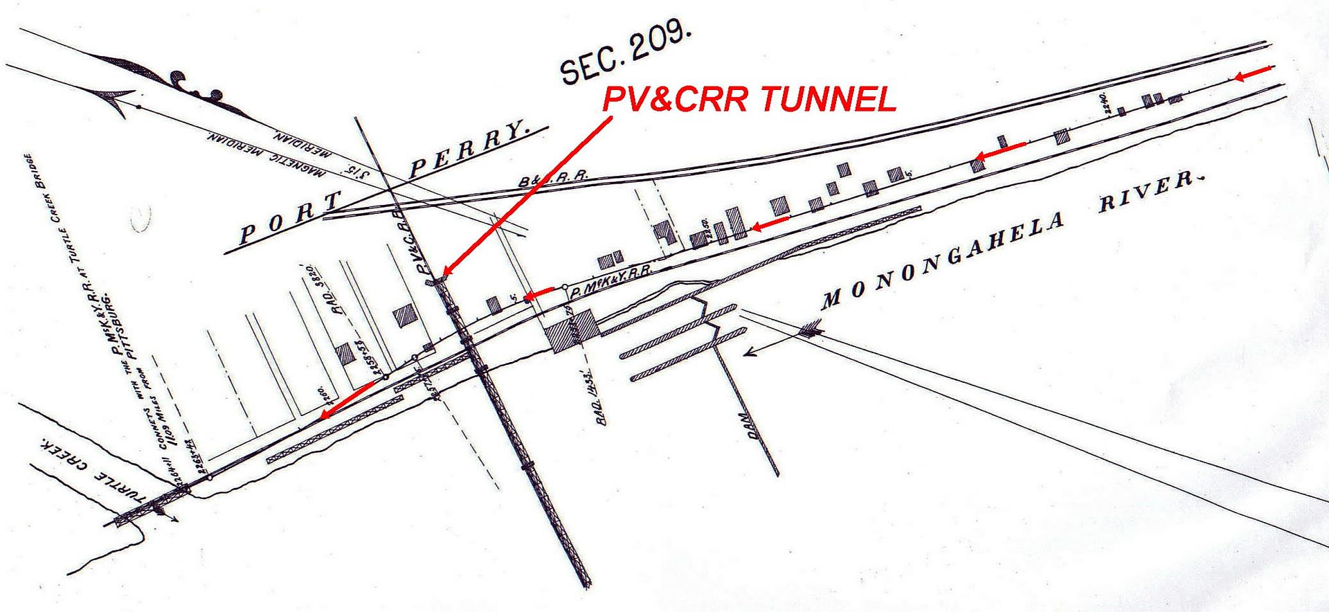
Above this South Penn survey map shows how the South Penn after descending the Mon River cliffs after leaving White Oak borough would merge onto the P&LE line just to the left of the Iron bridge. leading to the tunnel, just to the right of the steel plant.
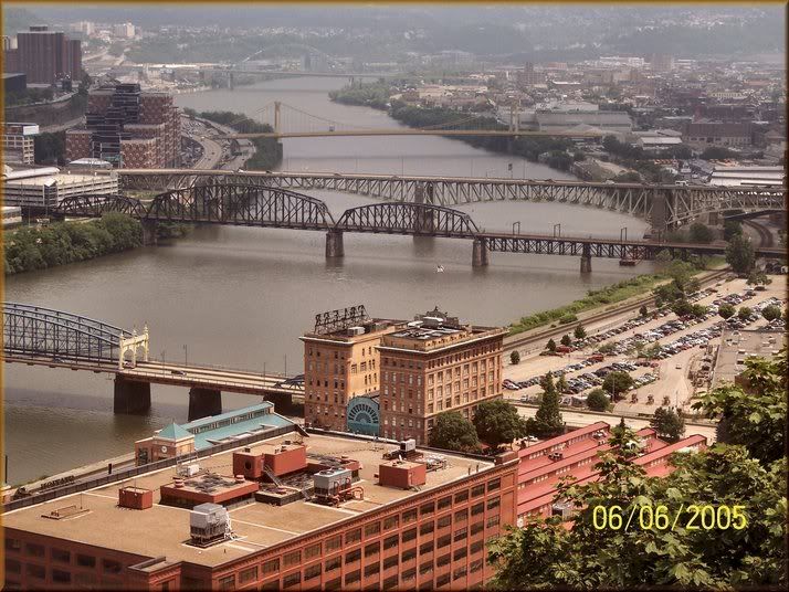
For passengers this site on the South Side of the Monongahela River was to be their final stop along the South Penn according to the 1884 report. Also in that report found on http://www.southpennrailroad.com and click on the report button to read the full report shows that the bridge in the foreground was also a fairly new bridge and could accomadate a train above its wagon grade to bring a line into downtown Pittsburgh. Of course that bridge is gone and a new one replaced it. Those old piers are still being used by the new bridge that you see in this photo.
"From the South Pennsylvania Railroad at Port Perry to Pittsburgh is eleven miles via the Pittsburgh, McKeesport and Youghiogheny Railroad. This line terminates in Birmingham on the southwest bank of the Monongahela River, near the west end of the new bridge. It is too remote from the center of Pittsburgh and Allegheny City, and to difficult of access to be able to attract much local travel in competition with the Pittsburgh and Connellsville Railroad, which has an admirably accessible terminal passenger and freight station on its eastern side of the river in the city, or with the Pennsylvania Railroad, with its admirable depot in the heart of the city. It is of the greatest importance to the South Pennsylvania railroad that a terminal station should be secured for it on the eastern side of the Monongahela River, right in the city. This can best be accomplished by the construction of a line down the east bank of the Monongahela, from North Homestead through Hazelwood to the old Pittsburgh Gas Works, and thence to the block on the south side of Smithfield street opposite the Monongahela House. A less costly way would be to build an extension of the Pittsburgh, McKeesport and Youghiogheny Railroad from its Birmingham terminus eastwardly across the Monongahela River into the City of Pittsburgh on a line parellel with and on the upper end of the piers of the
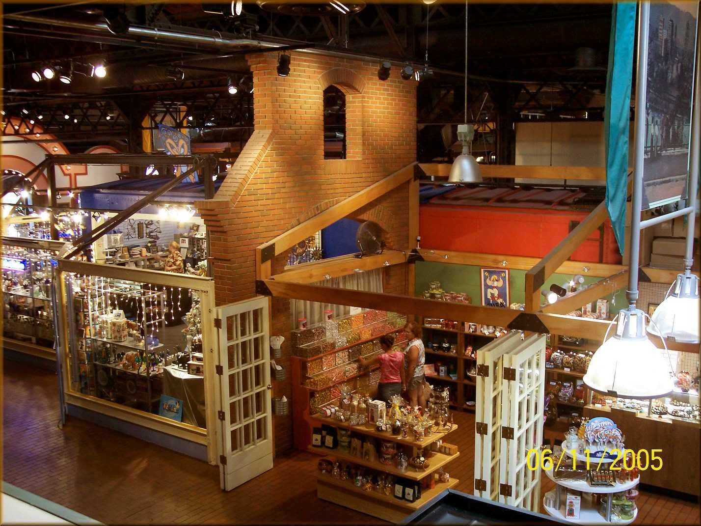
The P&LE Sta. is today a shopping mall. I kinda like the old box cars being used as small shops. Really worth taking a look see when in Pittsburgh. Plenty of parking but you have to pay.
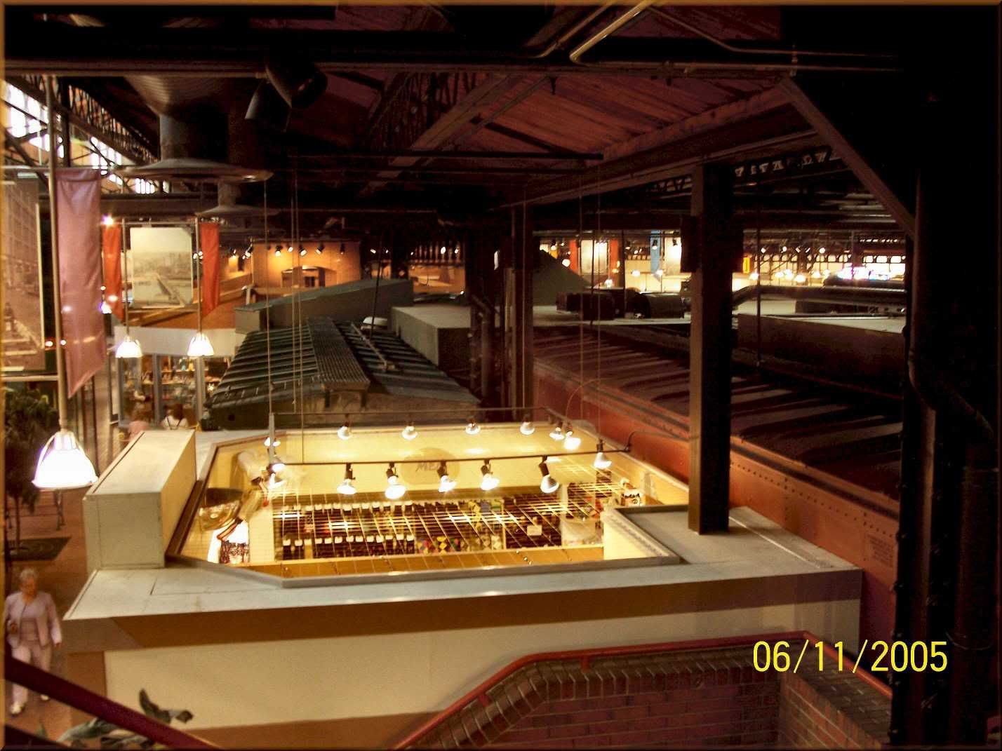
Russ, those are a nice photo collection of Pittsburgh views…Especially like the ones insde the Mall…{P&LE}, building. Is that the former station that has the restaurant in the main concourse space…I seem to remember seeing a pic some years ago of it. Never have been to that building. In fact believe the last time I visited Pittsburgh was to the civic center {believe that’s what it’s called…the one with the supposedly moveable roof}, to see a live broadcast {on large screen TV}, of the Indy 500 on Memorial Day…way back in the sixties. That was the race that at least 2 drivers were killed from a horrific crash and resulting fire.
Too bad Pittsburgh is not the giant in industrial works that it once was…If we could have the industrial might without the smoke it used to put out, wouldn’t that be great…!
Yes that is the P&LE station of 1897. Houses offices as well as Rest. ad mall. The mall is the old freight station.
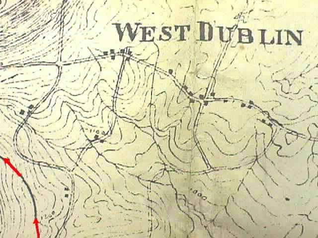
Where is West Dublin?
No I don’t mean Ireland.
However in the 1884 report Oliver Wendel Barne’s mentions that the South Penn was to pass by this town three miles to the south of it. Well you won’t find this town on any of todays map. I know I checked and only by using this South Penn survey map was I able to locate it.
On this small piece of survey map, you will see the South Penn curving westward, headed for the east end of the Sideling Hilll Tunnel.
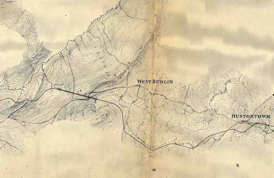
Here is a more wider map of the area east of the Sideling Hill Tunnel/Mountain.
Still maintain it would really have been neat if the 1885 builders and policy makers with Vanderbult could have completed their task…and…in later years, the Turnpike would still have been built. Trouble is if one was to be completed the other would not…!
If the tunnel bores would have been used by the RR, then part of the incentive to build the Turnpike would not have been available.
Believe the S P may have been a pretty strong competitor for the Pennsylvania RR…Shorter distance to Pittsburgh and points west. Pretty close to some mighty coal producing areas in Somerset Co, etc…
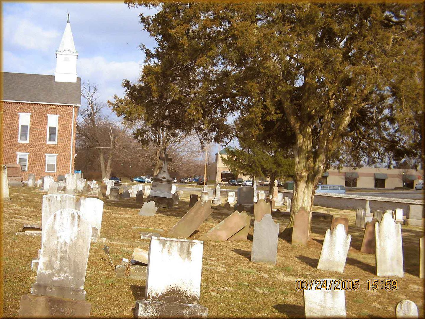
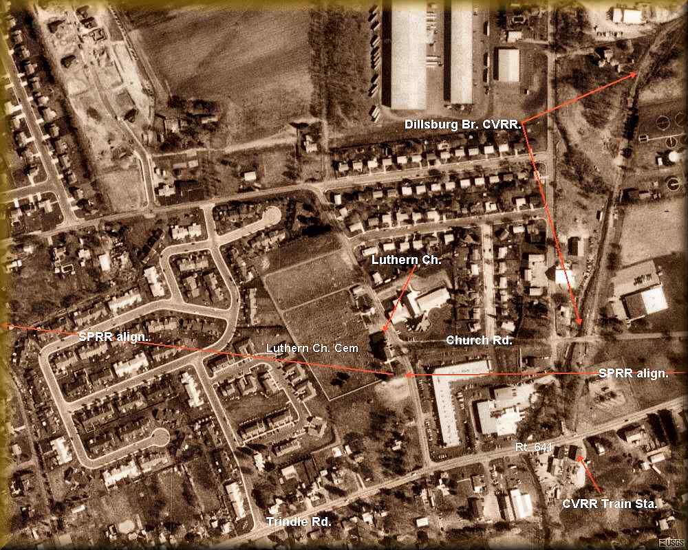
The South Penn had plans to remove the bodies from this cemetery in Mechanicsburg. Click on the report button @ web page, http://www.southpennrailroad.com you can read how the South Penn was to pass along Simpson Street and then continue west to Carlisle. To do so they were to pass or crosss the Dillsburg br. of the Cumberland Valley RR. Like a navigator, I was able to plot out this alignment and using a few landmarks stated in the 1881 railrod report, I was able to at first to speculate where the alignment was to be built. It wasn’t until I found these next set of papaers that I was able to pinpoint/confirm the exact alignment that I believed was the route passing through this cemetery.
 .
.
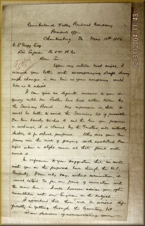
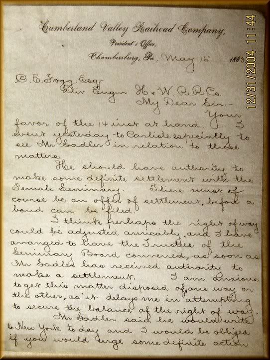
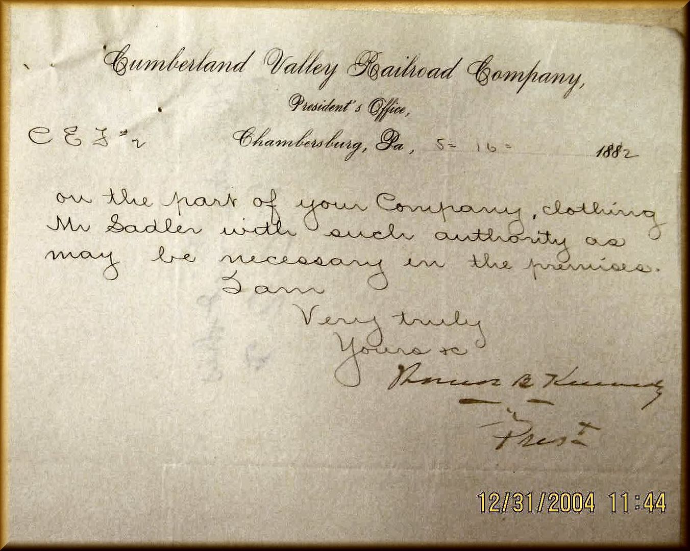
Letters between the CVRR and the South Penn concerning the removal and crossing of the dead and of the CVRR at the Dillsubug branch railroad crossing.
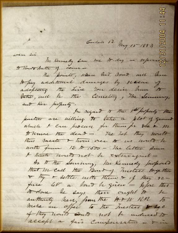
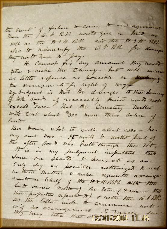
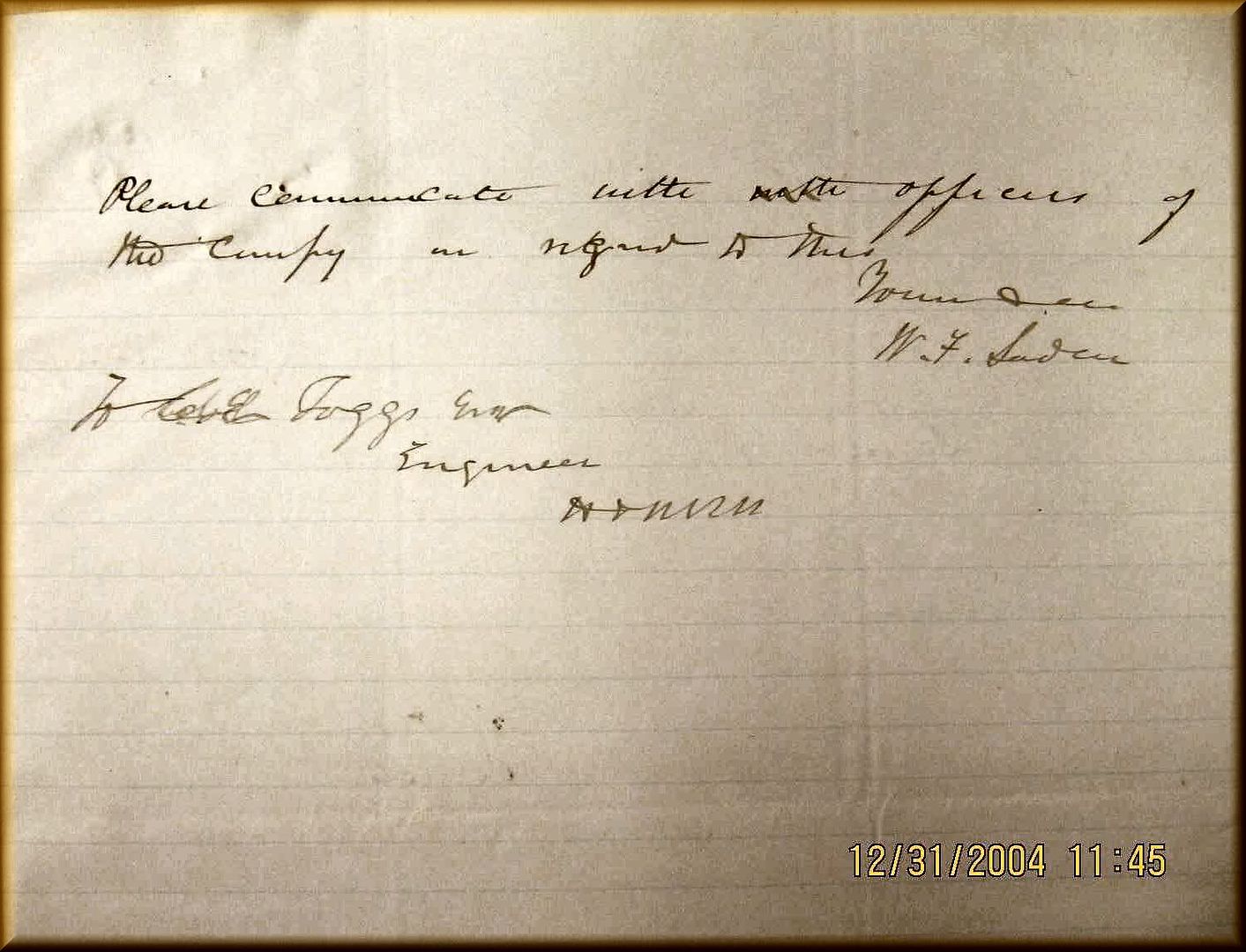
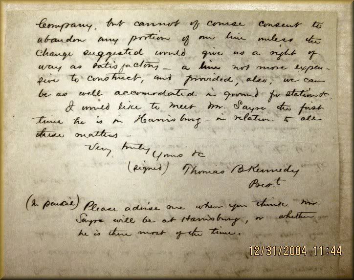
The last of the CVRR letters and responses. The one letter clearly shows the final decision to go ahead and remove the bodies. It never happened as the work of the South Penn was never completed. However other cemeteries along the route were disturbed as in Somerset County, Pa. Another in Westmoreland County was a close call but left standing as no work was done andthe map shows the leaving out and a cemetery boarder deflected from the cemetery edge.
…Thinking of an area of interest as the South Penn would have exited the west portal of the Quemahoming Tunnel, if my memory is correct…the ROW swings to the north and follows along the hillside making a large sweeping curve that comes back near or crosses the Turnpike location. Maybe you {Russ}, have that handy on an image or topo map we could see…If not I can pull it up on Google or TerraServer in image form and see if it shows…I believe it should as I have observed it in the area described while passing on the Turnpike. I find myself looking at locations like that when I pass on the pike so it keeps me busy to drive and look…ha.
[quote]
Originally posted by Modelcar
…Thinking of an area of interest as the South Penn would have exited the west portal of the Quemahoming Tunnel, if my memory is correct…the ROW swings to the north and follows along the hillside making a large sweeping curve that comes back near or crosses the Turnpike location. Maybe you {Russ}, have that handy on an image or topo map we could see…If not I can pull it up on Google or TerraServer in image form and see if it shows…I believe it should as I have observed it in the area described while passing on the Turnpike. I find myself looking at locations like that when I pass on the
Stand By! You know I have a picture of the grade at the 101.7 mile post Stand By Up-loading to photobucket first.
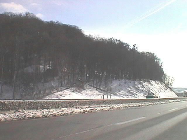
These two photos are showing diffrent time periods of the same area at the 101.7 mile post. I am driving east as you would atthe end of this month. This is the endof the grade on the north side of the turnpike just before crossing to reach the alignment to theLaurel Hill tunnel approach.